Snow Totals for Weekend Thus Far
 |
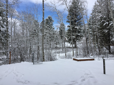
| 4 Inches Overnight at Star Valley Ranch bringing season total to 232 inches |
Public Information Statement
National Weather Service Riverton WY
0648 AM MST Sun Apr 09 2017


...Preliminary Snowfall Data from Friday night through Saturday
night...

Below are snowfall data from various sources and end times.

SnoTELS (Snow Telemetry) are remote sensing sites in high mountain
watersheds. Snowfall data from SNOTELS are estimated based on snow
water equivalent.

Location                              Snowfall
Lincoln County... Willow Creek Snotel... 16 inches. Cottonwood Creek Snotel... 14 inches. Blind Bull Summit Snotel... 12 inches. Commissary Ridge... 12 inches. 5 SSE Smoot... 11 inches. Blind Bull Summit... 11 inches. Spring Creek Divide Snotel... 10 inches. Salt River Summit Snotel... 9 inches. 3 SE Bedford... 8.5 inches. Afton... 8.3 inches. Star Valley Ranch... 8 inches. Indian Creek Snotel... 8 inches. 2 SE Thayne... 7 inches. Star Valley Ranch... 6.5 inches. Kelley Ranger Station Snotel... 6 inches. Box Y Ranch... 5 inches. Hams Fork Snotel... 2 inches.Big Horn County...
Bald Mountain Snotel... 4 inches.
Shell Creek Snotel... 2 inches.Fremont County...
Little Warm Snotel... 8 inches.
Brooks Lake... 7 inches.
Deer Park Snotel... 6 inches.
Hobbs Park Snotel... 5 inches.
Cold Springs Snotel... 4 inches.
South Pass Snotel... 3 inches.
Burroughs Creek Snotel... 1 inch.
Townsend Creek Snotel... 1 inch.
Dubois... 1 inch.Johnson County...
Bear Trap Meadow Snotel... 3 inches.
Hansen Sawmill Snotel... 1 inch.Natrona County...
Grave Spring Snotel... 2 inches.Park County...
Blackwater Snotel... 4 inches.
Evening Star Snotel... 3 inches.
Younts Peak Snotel... 2 inches.
Beartooth Lake Snotel... 1 inch.
Kirwin Snotel... 1 inch.
Pahaska... 0.2 inches.Sublette County...
Triple Peak Snotel... 15 inches.
Gunsite Pass Snotel... 12 inches.
Snider Basin Snotel... 6 inches.
Elkhart Park G.S. Snotel... 6 inches.
New Fork Lake Snotel... 5 inches.
Loomis Park Snotel... 5 inches.
14 NW Pinedale... 4.3 inches.
East Rim Divide Snotel... 4 inches.
Daniel Fish Hatchery... 3 inches.
Pinedale... 2.8 inches.
13 NE Big Piney... 2.5 inches.
Big Sandy Opening Snotel... 2 inches.
Kendall Ranger Station Snotel... 2 inches.
Larsen Creek Snotel... 1 inch.Teton County...
Grand Targhee Snotel... 14 inches.
Grand Targhee - Chief Joseph... 13 inches.
Jackson Hole - Rendezvous Bowl... 13 inches.
Jackson Hole - Mid Mountain... 9 inches.
Jackson Hole - Raymer... 8 inches.
Togwotee Mountain Lodge... 8 inches.
Togwotee Pass Snotel... 8 inches.
Darwin Ranch... 6.2 inches.
Phillips Bench Snotel... 6 inches.
Grassy Lake Snotel... 6 inches.
Jackson Hole - Base... 3 inches.
3 SSW Wilson... 2.5 inches.
Granite Creek Snotel... 2 inches.
Base Camp Snotel... 2 inches.
1 NNW Alta... 2 inches.
Jackson Dam... 1.1 inches.
Snake River Stn Snotel... 1 inch.
12 NE Jackson... 1 inch.
Moose... 0.4 inches.Washakie County...
Powder River Pass Snotel... 2 inches.Yellowstone National Park...
Lewis Lake Divide Snotel... 8 inches.
Canyon Snotel... 4 inches.
Parker Peak Snotel... 3 inches.
Sylvan Lake Snotel... 3 inches.
Thumb Divide Snotel... 2 inches.