High Pressure Ridge to Dominate Western Weather well into December- Mild and Dry
Once the current weather system departs Wyoming by late Monday an unseasonably large and persistent high pressure ridge develops along the West Coast. By the end of the week the ridge will extend all the way north to Alaska, steering storms well to the north of a normal track for December .
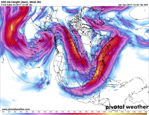
This model forecast above is for noon Friday. Very cool/cold air will drop southward from Northern Canada into the eastern half of the U.S. where the deep low pressure will set up. From the Rockies west to the coast, very dry and unseasonably warm weather will continue for an extended period.
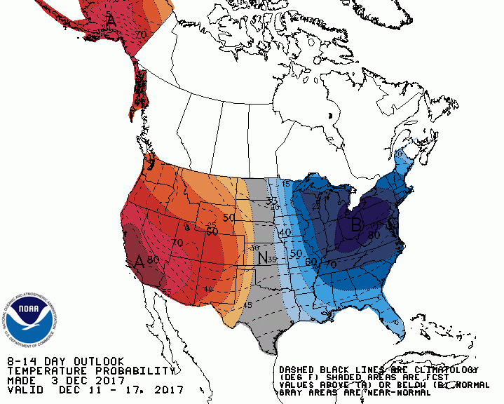
……….Temperature outlook for the period December 11-17 2017………..
………..Precipitation outlook for the period December 11-17 2017…………
The computer models persist in forecasting the large high pressure ridge along the west coast well into the middle of December.
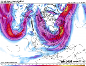
………..500 mb Forecast for mid day Wednesday December 13 2017………..
With this trend the latest Outlook for the month of December suggest the West remains warm and the East Cold
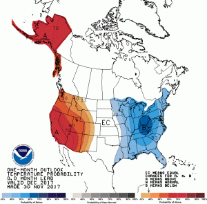
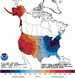
…………Temperature outlook for December………..
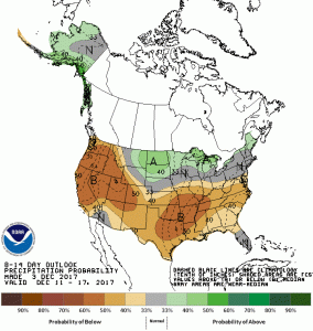
And with the storm track remaining well north of the Pacific Northwest, dry conditions are predicted much of the month.
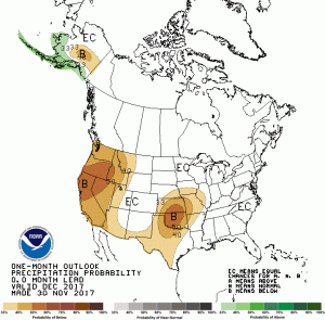
………..Precipitation Outlook for December………..
Given what is forecast for December, snow packs in the mountains will be slow to develop. Skiers may be hard pressed to find ideal conditions for much of the month.