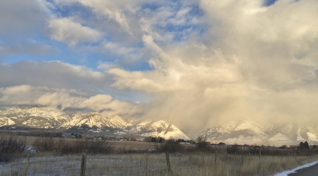
Clearing Skies in Star Valley

Public Information Statement

National Weather Service Riverton WY
225 PM MST Mon Dec 04 2017


...Preliminary Storm Information...

The snowfall started off lightly Sunday evening, and then increased
through the late night hours. The winter storm has now exited the
region leaving snowfall amounts from just a trace to up to 15
inches. Here are the updated amounts through 2 pm Monday.

Observations are collected from a variety of sources with varying
equipment and exposures. We thank all volunteer weather observers
for their dedication. Not all data listed are considered official.

Location                              Snowfall

Fremont County...
 St. Lawrence Alt Snotel...          12 inches.
 6 SW Lander...                     8.2 inches.
 Brooks Lake...                       8 inches.
 Hobbs Park Snotel...                 8 inches.
 Townsend Creek Snotel...             7 inches.
 Deer Park Snotel...                  7 inches.
 South Pass Snotel...                 6 inches.
 9 SSE Lander...                    5.8 inches.
 Hudson...                          5.5 inches.
 9 SSE Lander...                      5 inches.
 Atlantic City...                     5 inches.
 Lander Airport...                  4.1 inches.
 4 W Riverton...                      4 inches.
 7 WNW Lander...                    3.7 inches.
 Lander...                          3.7 inches.
 Riverton Airport...                  3 inches.
 2 W Riverton...                      3 inches.
 9 NW Riverton...                     3 inches.
 1 N Lander...                      2.5 inches.
 Jeffrey City...                      2 inches.
 Little Warm Snotel...                2 inches.
 Riverton...                        1.9 inches.
 2 W Riverton...                    1.8 inches.
 Cold Springs Snotel...               1 inch.
 Dubois...                            1 inch.
 Castle Creek Snotel...               1 inch.
 Boysen Dam...                      0.3 inches.

Hot Springs County...
 Thermopolis...                     3.9 inches.
 9 NE Thermopolis...                2.5 inches.

Johnson County...
 13 SSE Buffalo...                    1 inch.
 Buffalo...                    0.5 to 1 inch.
 4 SSW Buffalo...                     1 inch.

Lincoln County...
 Cottonwood Creek Snotel...          15 inches.
 Willow Creek Snotel...              13 inches.
 Commissary Ridge...                 12 inches.
 Indian Creek Snotel...               8 inches.
 Salt River Summit Snotel...          7 inches.
 5 NNE Thayne...                      5 inches.
 Hams Fork Snotel...                  5 inches.
 Spring Creek Divide Snotel...        5 inches.
 5 SSE Smoot...                       5 inches.
 Box Y Ranch...                       5 inches.
 Blind Bull Summit...                 5 inches.
 Kelley Ranger Station Snotel...      5 inches.
 Star Valley Ranch...                 4 inches.
 2 SE Thayne...                     3.5 inches.
 3 SE Bedford...                      3 inches.
 Blind Bull Summit Snotel...          3 inches.
 Afton...                           2.9 inches.

Natrona County...
 Casper Mountain Snotel...           14 inches.
 Reno Hill Snotel...                 11 inches.
 1 SW Casper...                       9 inches.
 Casper...                       7 to 9 inches.
 3 WSW Casper...                    8.8 inches.
 1 S Casper...                      8.2 inches.
 2 S Casper...                        8 inches.
 4 WSW Casper...                    7.8 inches.
 10 WSW Casper...                    7 inches.
 11 WSW Casper...                   6.6 inches.
 Casper Airport...                  5.2 inches.
 Powder River...                      5 inches.

Park County...
 Blackwater Snotel...                 5 inches.
 26 SW Cody...                        5 inches.
 Evening Star Snotel...               4 inches.
 Beartooth Lake Snotel...             3 inches.
 Kirwin Snotel...                     2 inches.
 3 NE Sunshine...                   1.7 inches.
 Marquette Snotel...                  1 inch.
 Pahaska...                           1 inch.
 Meeteetse...                         1 inch.
 2 WSW Cody...                        1 inch.

Sublette County...
 Triple Peak Snotel...                7 inches.
 Big Sandy Opening Snotel...          6 inches.
 Gunsite Pass Snotel...               5 inches.
 Pocket Creek Snotel...               5 inches.
 Larsen Creek Snotel...               4 inches.
 Loomis Park Snotel...                3 inches.
 Snider Basin Snotel...               3 inches.
 New Fork Lake Snotel...              2 inches.
 Bondurant...                         2 inches.
 Boulder Rearing Station...           1 inch.
 Pinedale...                        0.8 inches.
 14 NW Pinedale...                  0.2 inches.

Sweetwater County...
 7 SE Rock Springs...               1.7 inches.
 4 NNW Rock Springs...                1 inch.
 Rock Springs...                    0.8 inches.
 Green River...                     0.3 inches.

Teton County...
 Togwotee Pass Snotel...             11 inches.
 Jackson Hole - Rendezvous Bowl...    8 inches.
 Togwotee Mountain Lodge...           7 inches.
 Grassy Lake Snotel...                7 inches.
 Grand Targhee - Chief Joseph...      6 inches.
 Jackson Hole - Mid Mountain...     4.5 inches.
 Phillips Bench Snotel...             4 inches.
 Jackson Hole - Raymer...             4 inches.
 Snake River Stn Snotel...            3 inches.
 Granite Creek Snotel...              2 inches.
 Grand Targhee Snotel...              2 inches.
 Gros Ventre Summit Snotel...         2 inches.
 Snow King...                         1 inch.
 12 NE Jackson...                     1 inch.
 Base Camp Snotel...                  1 inch.
 Moose...                           0.8 inches.
 Jackson...                         0.5 inches.
 Jackson Hole - Base...             0.5 inches.

Washakie County...
 16 SSE Ten Sleep...                  3 inches.
 5 NNW Ten Sleep...                   1 inch.
 8 SW Worland...                      1 inch.
 Ten Sleep...                       0.4 inches.

Yellowstone National Park...
 Lamar Ranger Station...            5.2 inches.
 Thumb Divide Snotel...               4 inches.
 Tower Falls Ranger Station...        3 inches.
 Lewis Lake Divide Snotel...          3 inches.
 Parker Peak Snotel...                3 inches.
 Two Ocean Plateau Snotel...          3 inches.
 Canyon Snotel...                     2 inches.
 Sylvan Lake Snotel...                2 inches.
 Mammoth...                         1.9 inches.