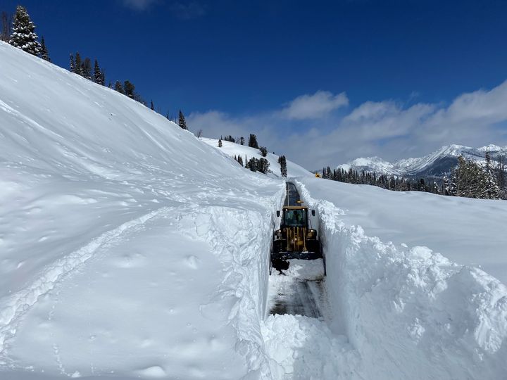
Galena Pass Idaho Avalanche Cleanup


National Weather Service Riverton WY
711 PM MDT Wed Apr 5 2023

...Final Snowfall Reports from Significant April Storm...

A significant spring storm brought heavy snow to much of central and
southern Wyoming. The following are snowfall reports of two or more
inches, generally spanning Sunday evening through Tuesday night. The
heaviest snow fell Monday morning through Monday night, especially
from South Pass through Natrona County. New all time snowfall record at Casper

Note: The numbers and letters listed in the locations below refer to
the miles and direction from the nearest town center.

Location                     Amount  Elevation (ft.)

...Fremont County...
Atlantic City                48.8 in    7815
7 NNW South Pass City        39.0 in    8941
10 NNW South Pass City       38.0 in    9674
13 SW Lander                 37.0 in    8714
14 SW Fort Washakie          28.0 in   10067
9 SW Lander                  26.0 in    7150
15 W Fort Washakie           24.0 in    8426
2 SSE Lander                 17.9 in    5518
6 SW Lander                  16.6 in    6046
2 SSE Fort Washakie          16.3 in    5555
6 WSW Dubois                 15.0 in    9419
11 WSW Burris                15.0 in    9909
1 NNW Lander                 14.7 in    5332
7 WNW Lander                 12.4 in    6035
9 SSE Lander                 11.0 in    5818
4 WNW Riverton               10.5 in    5166
1 NE Riverton                10.0 in    4949
6 WNW Riverton                9.2 in    5565
2 W Riverton                  9.1 in    5073
1 W Riverton                  7.5 in    5031
Hudson                        7.4 in    5098
1 WNW Dubois                  6.5 in    6947
6 ESE Dubois                  5.2 in    6657
11 N Dubois                   4.0 in    8658
12 NNW Shoshoni               3.0 in    4859
16 NE Dubois                  2.0 in    8410

...Hot Springs County...
23 WSW Hamilton Dome         25.0 in    8905
15 WSW Hamilton Dome          7.4 in    6608
1 WSW Lucerne                 3.7 in    4429
1 E Thermopolis               3.0 in    4324
2 NE Lucerne                  2.3 in    4280

...Johnson County...
16 W Buffalo                 11.0 in    8691
18 WNW Buffalo               10.0 in    9860
15 WSW Buffalo                9.0 in    8300
13 SSE Buffalo                8.0 in    4810
5 SSW Buffalo                 8.0 in    5296
27 WNW Buffalo                8.0 in    8543
14 WNW Mayoworth              8.0 in    8065
8 NNE Mayoworth               7.5 in    5070
1 E Buffalo                   7.0 in    4650
Buffalo                       6.6 in    4640

...Lincoln County...
2 SSW Fossil Butte National  22.8 in    6787
Afton                        20.0 in    6249
6 ENE Smoot                  12.0 in    8380
21 NE Cokeville              12.0 in    9329
2 NNW Turnerville            11.2 in    6346
8 S Smoot                    11.0 in    7577
15 NNE Cokeville             11.0 in    8368
3 SE Turnerville              9.0 in    8219
1 SE Thayne                   8.8 in    6079
4 NNE Thayne                  8.5 in    6247
15 ENE Cokeville              8.0 in    7886
5 NNE Thayne                  7.5 in    6370
15 ESE Smoot                  7.0 in    9033
Alpine                        3.5 in    5672
16 ENE Turnerville            3.0 in    8796

...Natrona County...
Casper Mountain              60.0 in    8000
2 SSW Casper                 39.3 in    5450
4 NW Mills                   37.4 in    5278
Casper Mountain SNOTEL       37.0 in    7900
2 SW Evansville              33.1 in    5151
1 SW Casper                  28.0 in    5321
1 NW Casper                  27.0 in    5138
22 SE Casper                 27.0 in    8401
1 WSW Casper                 24.5 in    5200
1 NW Powder River            14.0 in    5724
20 N Arminto                 10.0 in    8590
Midwest                       6.0 in    4862

...Park County...
6 SW Pitchfork               20.0 in    7925
15 SE Wapiti                 12.0 in    8918
2 SE Meeteetse                7.7 in    6068
5 NNE Meeteetse               4.3 in    5518
20 SW Pitchfork               3.0 in    9784
3 WSW Cody                    2.0 in    5286

...Sublette County...
11 E Big Sandy               10.0 in    9082
11 NNE Pinedale               7.0 in    9016
12 N Cora                     6.0 in    8392
6 NNE Big Sandy               6.0 in    9369
17 ESE Turnerville            6.0 in    8500
20 NW Calpet                  4.0 in    8065
12 ESE Bondurant              3.0 in    7953
6 WNW Cora                    2.9 in    7461

...Sweetwater County...
7 SSE Rock Springs           23.7 in    6752
1 SSW Green River            19.2 in    6307
2 NW Rock Springs            18.5 in    6300
1 NNW Green River            17.5 in    6086
2 SSW Rock Springs           17.0 in    6284
1 SSE Green River            15.8 in    6210
2 SSW Rock Springs           15.0 in    6284
2 SE Green River             14.6 in    6168
2 SSE Green River            13.5 in    6204
2 NNE Farson                  7.0 in    6624

...Teton County...
23 ESE Moran Junction         2.0 in    9624

...Washakie County...
12 SE Big Trails             15.0 in    7628
18 ENE Ten Sleep              5.0 in    9455

Observations are collected from a variety of sources with varying
equipment and exposures. We thank all volunteer weather observers
for their dedication. Not all data listed are considered official.
Galena Pass Idaho Avalanche Cleanup
National Weather Service Riverton WY
711 PM MDT Wed Apr 5 2023
...Final Snowfall Reports from Significant April Storm...
A significant spring storm brought heavy snow to much of central and
southern Wyoming. The following are snowfall reports of two or more
inches, generally spanning Sunday evening through Tuesday night. The
heaviest snow fell Monday morning through Monday night, especially
from South Pass through Natrona County. New all time snowfall record at Casper
Note: The numbers and letters listed in the locations below refer to
the miles and direction from the nearest town center.
Location Amount Elevation (ft.)
...Fremont County...
Atlantic City 48.8 in 7815
7 NNW South Pass City 39.0 in 8941
10 NNW South Pass City 38.0 in 9674
13 SW Lander 37.0 in 8714
14 SW Fort Washakie 28.0 in 10067
9 SW Lander 26.0 in 7150
15 W Fort Washakie 24.0 in 8426
2 SSE Lander 17.9 in 5518
6 SW Lander 16.6 in 6046
2 SSE Fort Washakie 16.3 in 5555
6 WSW Dubois 15.0 in 9419
11 WSW Burris 15.0 in 9909
1 NNW Lander 14.7 in 5332
7 WNW Lander 12.4 in 6035
9 SSE Lander 11.0 in 5818
4 WNW Riverton 10.5 in 5166
1 NE Riverton 10.0 in 4949
6 WNW Riverton 9.2 in 5565
2 W Riverton 9.1 in 5073
1 W Riverton 7.5 in 5031
Hudson 7.4 in 5098
1 WNW Dubois 6.5 in 6947
6 ESE Dubois 5.2 in 6657
11 N Dubois 4.0 in 8658
12 NNW Shoshoni 3.0 in 4859
16 NE Dubois 2.0 in 8410
...Hot Springs County...
23 WSW Hamilton Dome 25.0 in 8905
15 WSW Hamilton Dome 7.4 in 6608
1 WSW Lucerne 3.7 in 4429
1 E Thermopolis 3.0 in 4324
2 NE Lucerne 2.3 in 4280
...Johnson County...
16 W Buffalo 11.0 in 8691
18 WNW Buffalo 10.0 in 9860
15 WSW Buffalo 9.0 in 8300
13 SSE Buffalo 8.0 in 4810
5 SSW Buffalo 8.0 in 5296
27 WNW Buffalo 8.0 in 8543
14 WNW Mayoworth 8.0 in 8065
8 NNE Mayoworth 7.5 in 5070
1 E Buffalo 7.0 in 4650
Buffalo 6.6 in 4640
...Lincoln County...
2 SSW Fossil Butte National 22.8 in 6787
Afton 20.0 in 6249
6 ENE Smoot 12.0 in 8380
21 NE Cokeville 12.0 in 9329
2 NNW Turnerville 11.2 in 6346
8 S Smoot 11.0 in 7577
15 NNE Cokeville 11.0 in 8368
3 SE Turnerville 9.0 in 8219
1 SE Thayne 8.8 in 6079
4 NNE Thayne 8.5 in 6247
15 ENE Cokeville 8.0 in 7886
5 NNE Thayne 7.5 in 6370
15 ESE Smoot 7.0 in 9033
Alpine 3.5 in 5672
16 ENE Turnerville 3.0 in 8796
...Natrona County...
Casper Mountain 60.0 in 8000
2 SSW Casper 39.3 in 5450
4 NW Mills 37.4 in 5278
Casper Mountain SNOTEL 37.0 in 7900
2 SW Evansville 33.1 in 5151
1 SW Casper 28.0 in 5321
1 NW Casper 27.0 in 5138
22 SE Casper 27.0 in 8401
1 WSW Casper 24.5 in 5200
1 NW Powder River 14.0 in 5724
20 N Arminto 10.0 in 8590
Midwest 6.0 in 4862
...Park County...
6 SW Pitchfork 20.0 in 7925
15 SE Wapiti 12.0 in 8918
2 SE Meeteetse 7.7 in 6068
5 NNE Meeteetse 4.3 in 5518
20 SW Pitchfork 3.0 in 9784
3 WSW Cody 2.0 in 5286
...Sublette County...
11 E Big Sandy 10.0 in 9082
11 NNE Pinedale 7.0 in 9016
12 N Cora 6.0 in 8392
6 NNE Big Sandy 6.0 in 9369
17 ESE Turnerville 6.0 in 8500
20 NW Calpet 4.0 in 8065
12 ESE Bondurant 3.0 in 7953
6 WNW Cora 2.9 in 7461
...Sweetwater County...
7 SSE Rock Springs 23.7 in 6752
1 SSW Green River 19.2 in 6307
2 NW Rock Springs 18.5 in 6300
1 NNW Green River 17.5 in 6086
2 SSW Rock Springs 17.0 in 6284
1 SSE Green River 15.8 in 6210
2 SSW Rock Springs 15.0 in 6284
2 SE Green River 14.6 in 6168
2 SSE Green River 13.5 in 6204
2 NNE Farson 7.0 in 6624
...Teton County...
23 ESE Moran Junction 2.0 in 9624
...Washakie County...
12 SE Big Trails 15.0 in 7628
18 ENE Ten Sleep 5.0 in 9455
Observations are collected from a variety of sources with varying
equipment and exposures. We thank all volunteer weather observers
for their dedication. Not all data listed are considered official.