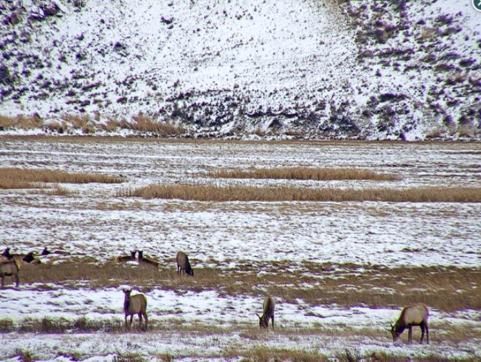
 Double L Ranch
Public Information Statement
National Weather Service Riverton WY
1250 PM MST Fri Nov 23 2018

...Preliminary Storm Report...
The following are snowfall reports from Thursday afternoon through
11 am Friday. It also includes the peak wind reports through 6 am
Friday. This will be the final report from the November 22-23rd
winter storm.

Observations are collected from a variety of sources with varying
equipment and exposures. We thank all volunteer weather observers
for their dedication. Not all data listed are considered official.

Note: SnoTELS (Snow Telemetry) are remote sensing sites in high
mountain watersheds. Snowfall data from SNOTELS are estimated based
on snow water equivalent.

Location                             Snowfall

Big Horn County...
 Bald Mountain Snotel...              4 inches.
 Bone Springs Divide Snotel...        3 inches.
 Shell Creek Snotel...                2 inches.
 Greybull...                        0.5 inches.

Fremont County...
 South Pass Snotel...                 3 inches.
 Atlantic City...                   2.1 inches.
 Cold Springs Snotel...               2 inches.
 Brooks Lake...                       2 inches.
 St. Lawrence Alt Snotel...           2 inches.
 Deer Park Snotel...                  2 inches.
 Hobbs Park Snotel...                 1 inch.
 Townsend Creek Snotel...             1 inch.
 Burroughs Creek Snotel...            1 inch.

Lincoln County...
 Blind Bull Summit...                 9 inches.
 Box Y Ranch...                       8 inches.
 Blind Bull Summit Snotel...          8 inches.
 Commissary Ridge...                  8 inches.
 Spring Creek Divide Snotel...        7 inches.
 Cottonwood Creek Snotel...           5 inches.
 5 SSE Smoot...                       5 inches.
 Willow Creek Snotel...               5 inches.
 3 SE Bedford...                      4 inches.
 Indian Creek Snotel...               4 inches.
 Kelley Ranger Station Snotel...      4 inches.
 Salt River Summit Snotel...          4 inches.
 Star Valley Ranch...               3.5 inches.
 2 SE Thayne...                     3.5 inches.
 Hams Fork Snotel...                  3 inches.
 Afton...                           2.6 inches.

Park County...
 Evening Star Snotel...               5 inches.
 Blackwater Snotel...                 5 inches.
 Wolverine Snotel...                  4 inches.
 Pahaska...                           4 inches.
 Beartooth Lake Snotel...             4 inches.
 Kirwin Snotel...                     2 inches.
 Younts Peak Snotel...                2 inches.

Sublette County...
 Triple Peak Snotel...                7 inches.
 Snider Basin Snotel...               6 inches.
 Loomis Park Snotel...                5 inches.
 Gunsite Pass Snotel...               4 inches.
 East Rim Divide Snotel...            4 inches.
 Kendall Ranger Station Snotel...     3 inches.
 Bondurant...                       2.8 inches.
 14 NW Pinedale...                    2 inches.
 Big Sandy Opening Snotel...          2 inches.
 Larsen Creek Snotel...               2 inches.
 Pinedale...                          1 inch.
 Daniel Fish Hatchery...              1 inch.
 New Fork Lake Snotel...              1 inch.
 Elkhart Park G.S. Snotel...          1 inch.
 Pocket Creek Snotel...               1 inch.

Sweetwater County...
 Rock Springs...                    0.1 inches.

Teton County...
 6 NW Moose...                       10 inches.
 Jackson Hole - Raymer...            10 inches.
 Jackson Hole - Rendezvous Bowl...    9 inches.
 Grand Targhee Snotel...              9 inches.
 Phillips Bench Snotel...             8 inches.
 Jackson Hole - Mid Mountain...       8 inches.
 Grassy Lake Snotel...                7 inches.
 Snow King...                         6 inches.
 Snake River Stn Snotel...            6 inches.
 Grand Targhee - Chief Joseph...      6 inches.
 Base Camp Snotel...                  6 inches.
 Jackson Hole - Base...               5 inches.
 Togwotee Mountain Lodge...           4 inches.
 5 NW Jackson...                      4 inches.
 Granite Creek Snotel...              4 inches.
 Togwotee Pass Snotel...              4 inches.
 2 NE Teton Village...              3.8 inches.
 Moose...                             3 inches.
 Jackson...                         2.5 inches.
 Gros Ventre Summit Snotel...         2 inches.

Yellowstone National Park...
 Lewis Lake Divide Snotel...         10 inches.
 Two Ocean Plateau Snotel...          7 inches.
 Thumb Divide Snotel...               7 inches.
 Sylvan Lake Snotel...                5 inches.
 Sylvan Road Snotel...                4 inches.
 Parker Peak Snotel...                3 inches.
 Canyon Snotel...                     2 inches.
 Lamar Ranger Station...            0.6 inches.

***** PEAK WIND REPORTS Through 6 am Friday*****

Location                     Speed     Time/Date       Elevation
(ft.)

...Fremont County...
7 SW Muddy Gap               52 MPH    0350 AM 11/23   7380
10 W Fort Washakie           48 MPH    0301 AM 11/23   9235

...Hot Springs County...
Boysen Peak                  47 MPH    0235 AM 11/23   7300

...Johnson County...
18 NW Buffalo                47 MPH    0247 AM 11/23   8604

...Lincoln County...
Mt Coffin                    53 MPH    1100 PM 11/22   10870

...Natrona County...
Casper Outer Drive           61 MPH    0401 PM 11/22   5463
16 S Hiland                  53 MPH    0510 PM 11/22   6380
8 S Casper                   47 MPH    0152 PM 11/22   7740
Casper Airport               46 MPH    1012 AM 11/22   5320

...Park County...
Hoyt Peak                    56 MPH    0300 AM 11/23   9800
Chief Joseph Hwy             50 MPH    1145 PM 11/22   8136

...Sweetwater County...
15 SE Rock Springs           48 MPH    0144 AM 11/23   7550

...Teton County...
Summit - Jackson Resort      58 MPH    0430 AM 11/23   10318
5 ENE Alta - Freds Mtn       51 MPH    0415 AM 11/23   9840
Raymer - Jackson Resort      50 MPH    1100 PM 11/22   9360
6 NW Moose                   45 MPH    0400 AM 11/23   9770