There are currently 5 Davis weather stations that have been providing data for over a year in the lower valley portion of Star Valley. Following is a map of those stations which also includes the Cakebread site where observations have only been available since last summer.
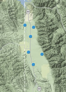 |
| Davis weather stations currently available online |
The following are the annual summaries for these stations
 |
| Star Valley Ranch |
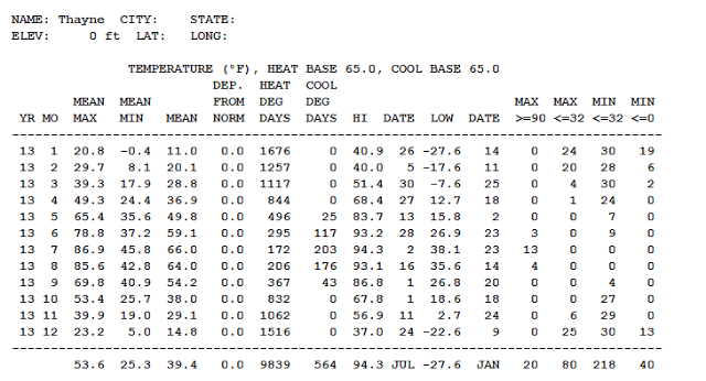 |
| Thayne Elementary School |
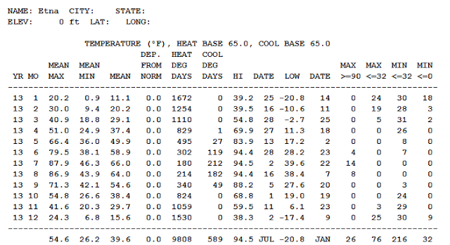 |
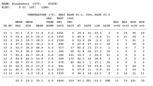
| Etna Elementary School |
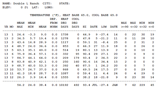 |
| Double L Ranch |
 |
| 2 Miles northeast of Etna |
None of these stations have a complete record of precipitation as it is very difficult to measure snow.
The one currently available record of how much precipitation occurred during the year was from Star Valley Ranch
 |
| This is the total rain and snow for the year at Star Valley Ranch |
For the state of Wyoming the following graphics are available for 2013
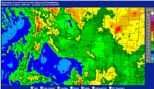 |
| Total Precipitation in 2013
|
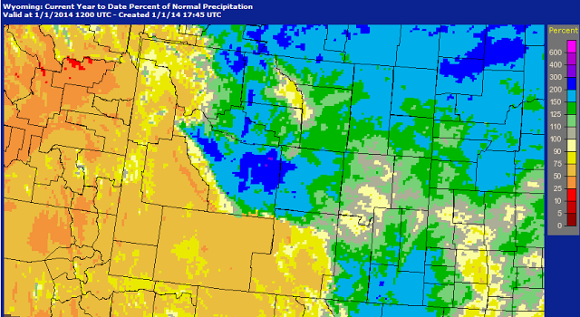 |
| Percent of Normal Precipitation 2013 |


