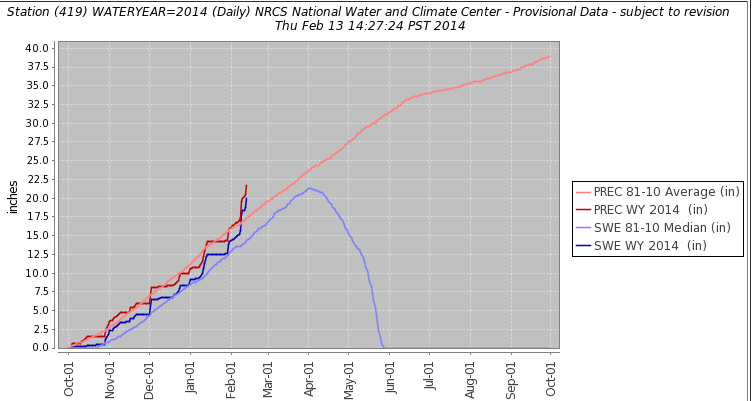
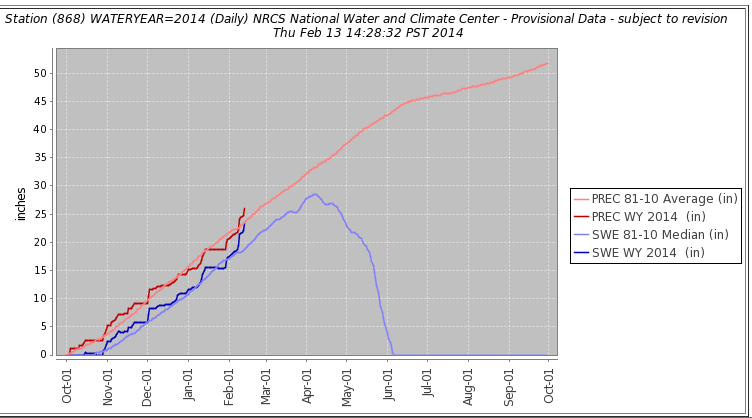
There has been a dramatic improvement in the winter snowpack in much of the mountains of western Wyoming. To illustrate the two important SNOTEL sites in the Salt Range are now substantially above normal levels for the season.
 |
| Cottonwood SNOTEL as of Feb 13 2014 |
|
 |
| Willow Creek SNOTEL as of Feb 13 2014 |
|
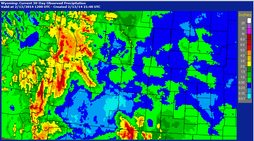
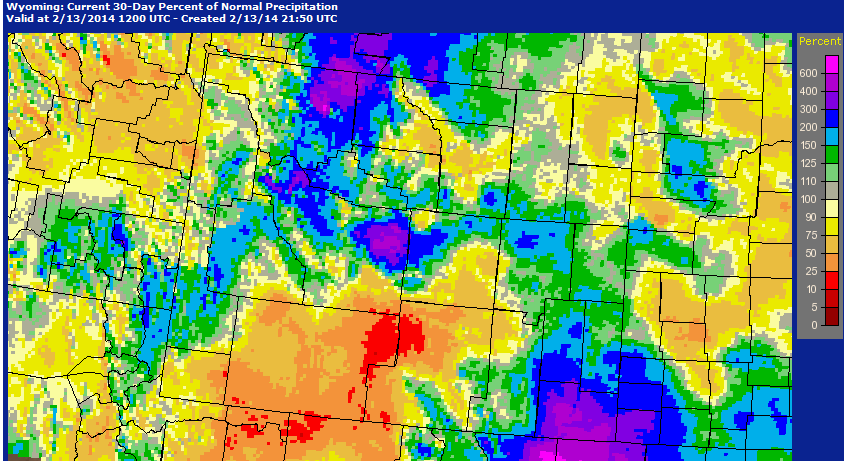
Over the past 30 days much of Wyoming has fared well, particularly west of the Continental Divide.
 |
| Precipitation in inches from January 14-February 13 2014 |
|
 |
| Percent of Normal precipitation from January 14-February 13 2014 |
|
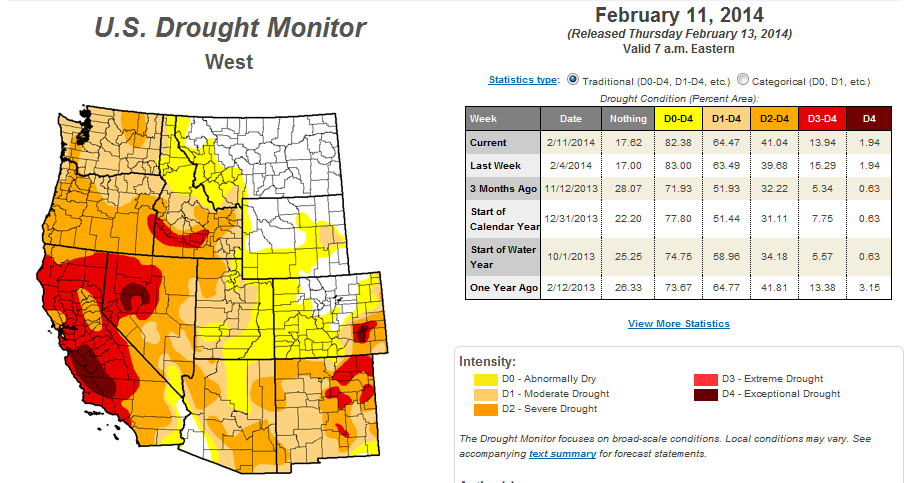
The latest drought condition map show that Wyoming generally has little concern unlike further south and west.
Another wet storm will be moving into the Northwestern States and bring more snow to Western Wyoming over the next days. It will be a rather warm storm, with at least rain at times in the valleys below 7000 feet, including Star Valley.
 |
| Forecast precipitation from 6pm Thursday Feb 13-6pm Sunday Feb 16 2014. |
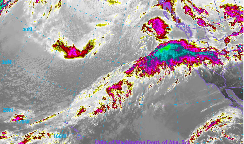
The infrared satellite image Thursday afternoon show the stream of moisture originating from near Hawaii heading toward Wyoming.
 |
| Add caption |