Bitter Cold Friday Morning Wyoming and surrounding States
 |
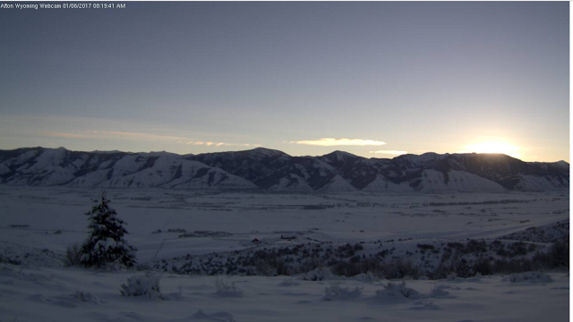
| Sunrise over Afton Friday Morning |
Bitter Cold again Friday morning across all of Wyoming and adjacent states. In Star Valley temperatures dropped to below -30F in coldest locations near the Salt River with unofficial reports of 40F below vicinity of Auburn. Following is the map of lowest temperatures observed as of 8am this morning.
 |
| Minimum temperatures as of 8am Friday morning |
It is not nearly as cold in the higher elevation locations in the nearby mountains above the strong valley inversions,
The following map show those temperatures observed below -30F this morning. Note the -53F at Peters Sink in the high mountain valley west of Bear Lake. Peter Sink is known for its cold holding the Utah state record of -69F observed February 1 1985.
 |
Minimums on Friday January 6 below -30F
Public Information Statement National Weather Service Riverton WY 1035 AM MST Fri Jan 6 2017 FRIGID TEMPERATURES OCCURRED ACROSS WESTERN AND CENTRAL WYOMING THIS MORNING. LOWS OF 25 TO 45 BELOW ZERO WERE QUITE COMMON ACROSS THE AREA. THE LOWEST TEMPERATURES ACROSS THE STATE THIS MORNING OCCURRED AT A LOCATION 8 MILES EAST OF ROCK SPRINGS WHERE A LOW TEMPERATURE OF 45 DEGREES BELOW WAS RECORDED. THE FOLLOWING IS A LIST OF THE COLDEST LOW TEMPERATURES THAT OCCURRED ACROSS WESTERN AND CENTRAL WYOMING THIS MORNING. ...Low Temperature Reports... Location Temp Elevation (ft.) ...Wyoming... ...Big Horn County... Basin -28 F 3897 Greybull Airport -28 F 3935 Greybull -30 F 3860 ...Fremont County... Boysen Reservoir -25 F 4710 Burris -25 F 6120 Fort Washakie -25 F 5565 Riverton Airport -25 F 5525 Boysen Dam -25 F 4760 10 SE Crowheart -26 F 5654 Riverton - CWC -29 F 5372 14 ENE Dubois -31 F 7365 Lander -31 F 5320 Hudson -32 F 5090 Jeffrey City -33 F 6374 Riverton -33 F 4950 Jeffrey City -36 F 6320 2 S Riverton -38 F 4901 ...Hot Springs County... Kirby -25 F 4350 Thermopolis 9 NE -33 F 4280 ...Johnson County... Kaycee - Coop -30 F 4660 ...Lincoln County... Afton - Coop -26 F 6245 Etna -26 F 5823 13 E Cokeville -27 F 7460 4 W Kemmerer -28 F 6989 Thayne -29 F 5928 Box Y Ranch -30 F 6650 1 NW Afton -31 F 6211 3 NW Etna -31 F 5692 Kemmerer -32 F 6980 3 NW Etna -32 F 5676 6 WNW Granger -32 F 6359 Cokeville -34 F 6191 Afton Airport -35 F 6220 Cokeville -35 F 6160 4 E Sage Junction -37 F 6387 4 E Opal -39 F 6589 5 SSE La Barge -40 F 6530 3 E Sage Junction -40 F 6378 4 S Cokeville -40 F 6185 13 W Kemmerer -41 F 6718 ...Natrona County... Pathfinder Reservoir -28 F 5858 Independence Rock -41 F 5920 ...Park County... 6 SW Meeteetse -25 F 6238 9 E Tower Junction -28 F 7266 Sylvan Lake -28 F 8420 4 W Pahaska -30 F 7120 East Entrance Yellowstone Np -31 F 6951 Pahaska -31 F 6696 1 SW Canyon -33 F 8090 NE Entrance Yellowstone -35 F 7360 Lamar Ranger Station -41 F 6555 ...Sublette County... 6 NW Cora -26 F 7462 Snider Basin -26 F 8060 7 NE Pinedale -28 F 8530 Boulder Lake -29 F 7350 8 SE Bondurant -29 F 7797 14 N Farson -31 F 6780 1 NE Pinedale -31 F 7382 21 W Big Piney -33 F 8200 10 NNW Daniel -33 F 7470 9 NW Marbleton -36 F 7176 Pinedale Airport -36 F 7085 Big Piney Airport -37 F 6974 2 NW Bondurant -38 F 6726 9 E Big Piney -42 F 6803 Bondurant -44 F 6650 Boulder Rearing Station - Co -44 F 6940 ...Sweetwater County... 1 NNE Green River -25 F 6315 16 W Red Desert -25 F 6805 Green River -27 F 6133 9 WNW Green River -27 F 6290 Green River -28 F 6091 Green River -28 F 6060 Flaming Gorge - Buckboard Ma -29 F 6080 6 WSW Rock Springs -29 F 6212 7 WNW Green River -30 F 6387 Farson - Coop -32 F 6675 23 W Wamsutter -32 F 6804 Farson -32 F 6594 I 80 - Mile Marker 124 -34 F 6475 7 WSW Rock Springs -34 F 6238 20 ENE Opal -35 F 6556 3 NW Rock Springs -35 F 6458 12 W Green River -37 F 6130 4 NE Bitter Creek -38 F 6720 5 SSE Point Of Rocks -39 F 6568 3 ENE Granger -40 F 6254 I 80 - Mile Marker 131 -40 F 6636 5 E Rock Springs -44 F 6369 8 E Rock Springs -45 F 6339 ...Teton County... Moran -25 F 6800 4 SW Jackson -26 F 6073 4 W South Entrance Ynp -26 F 7040 32 ESE Jackson -27 F 8750 Snake River Ranger Station -27 F 6882 Jackson -29 F 6240 1 W Grant Village -30 F 7874 2 S Grant Village -31 F 7980 3 SW Moose -32 F 6440 10 N Bondurant -32 F 6770 Moose -32 F 6466 Jackson - Coop -32 F 6210 Jackson Hole Airport -36 F 6445 ...Washakie County... Worland -30 F 4042 6 SE Ten Sleep -32 F 4541 Worland Airport -32 F 4245 Observations are collected from a variety of sources with varying equipment and exposures. Not all data listed are considered official. |