Preliminary Snowfall Reports through Thursday Morning
 |
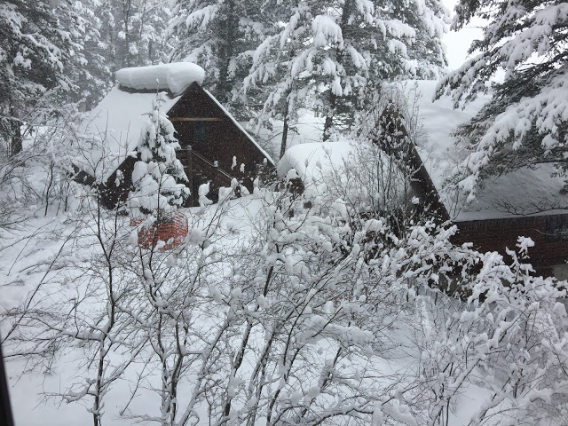
| Morning view at Star Valley Ranch |
Public Information Statement
National Weather Service Riverton WY
110 PM MST Thu Feb 23 2017

...Preliminary Snowfall Reports through Thursday Morning...

The following snow reports are preliminary totals from 6 pm
Wednesday night through 9 am Thursday morning from an ongoing major
winter storm.

Note: SnoTELs (Snow Telemetry) are remote sensing sites in high
mountain watersheds. Snowfall data from SNOTELS are estimated based
on snow water equivalent.

Location                              Snowfall
Lincoln County... Kelley Ranger Station Snotel... 6 inches. Willow Creek Snotel... 6 inches. Star Valley Ranch... 5.5 inches. Hams Fork Snotel... 4 inches. Spring Creek Divide Snotel... 4 inches. Salt River Summit Snotel... 3 inches. Cottonwood Creek Snotel... 3 inches. Indian Creek Snotel... 3 inches. 2 SE Thayne... 2 inches. 3 SE Bedford... 2 inches. Blind Bull Summit... 1 inch. Afton... 0.7 inches.Big Horn County...
Bald Mountain Snotel... 2 inches.Fremont County...
Hobbs Park Snotel... 18 inches.
Cold Springs Snotel... 18 inches.
Townsend Creek Snotel... 17 inches.
St. Lawrence Alt Snotel... 17 inches.
Deer Park Snotel... 17 inches.
South Pass Snotel... 14 inches.
Atlantic City... 11 inches.
Lander Airport... 9.4 inches.
6 SW Lander... 8.3 inches.
Little Warm Snotel... 8 inches.
2 W Riverton... 7 inches.
Hudson... 7 inches.
Lander... 4 to 6 inches.
Jeffrey City... 5 inches.
7 WNW Lander... 4.3 inches.
Riverton Airport... 4.1 inches.
9 SSE Lander... 4 inches.
6 N Riverton... 3.5 inches.
2 W Riverton... 3 inches.
9 SSE Lander... 3 inches.
Dubois... 1 inch.
Burris... 0.2 inches.Hot Springs County...
Owl Creek Snotel... 3 inches.
Thermopolis... 1 inch.Johnson County...
4 SSW Buffalo... 3 inches.
Hansen Sawmill Snotel... 2 inches.
Little Goose Snotel... 1 inch.
Buffalo... 1 inch.
Cloud Peak Reservoir Snotel... 1 inch.Lincoln County...
Kelley Ranger Station Snotel... 6 inches.
Willow Creek Snotel... 6 inches.
Star Valley Ranch... 5.5 inches.
Hams Fork Snotel... 4 inches.
Spring Creek Divide Snotel... 4 inches.
Salt River Summit Snotel... 3 inches.
Cottonwood Creek Snotel... 3 inches.
Indian Creek Snotel... 3 inches.
2 SE Thayne... 2 inches.
3 SE Bedford... 2 inches.
Blind Bull Summit... 1 inch.
Afton... 0.7 inches.Natrona County...
Casper... 4 to 16 inches.
Casper Mountain Snotel... 13 inches.
Casper Mountain... 12 inches.
Reno Hill Snotel... 9 inches.
Casper Airport... 8.2 inches.
5 SSW Casper... 5.5 inches.
10 WSW Casper... 3 inches.
Powder River... 2 inches.
Grave Spring Snotel... 1 inch.
Midwest... 1 inch.Park County...
Timber Creek Snotel... 6 inches.
1 NW Meeteetse... 5 inches.
3 NE Sunshine... 4 inches.
Marquette Snotel... 4 inches.
Kirwin Snotel... 3 inches.
Wolverine Snotel... 1 inch.
2 WSW Cody... 1 inch.
Cody... 1 inch.Sublette County...
Snider Basin Snotel... 4 inches.Sweetwater County...
Rock Springs... 5 to 7 inches.
Buckboard Marina... 6 inches.
Green River... 5 to 6 inches.
Rock Springs... 5.2 inches.
4 NNW Rock Springs... 4.5 inches.Washakie County...
Middle Powder Snotel... 1 inch.Yellowstone National Park...
Yellowstone East Entrance... 1 inch.