URGENT - WINTER WEATHER MESSAGE
National Weather Service Riverton WY
219 AM MDT Mon Apr 24 2017

...SNOW RETURNING FOR MANY MOUNTAIN LOCATIONS AND NORTHERN JOHNSON
COUNTY...

.An approaching Pacific cold front and upper level disturbance
will bring snow to many of the mountains of western and central
Wyoming from today through Tuesday.


Salt River and Wyoming Ranges-
219 AM MDT Mon Apr 24 2017

...WINTER WEATHER ADVISORY REMAINS IN EFFECT FROM 9 AM THIS
MORNING TO NOON MDT TUESDAY...

* TIMING...Snow will return later this morning and continue
  through tonight before tapering off Tuesday morning. The heaviest
  snow is expected later this afternoon and this evening.

* TOTAL SNOWFALL...5 to 10 inches.

* MAIN IMPACT...Highways will become slick and snow covered,
  including Salt Pass. Visibility could be reduced to under one
  half mile at times.
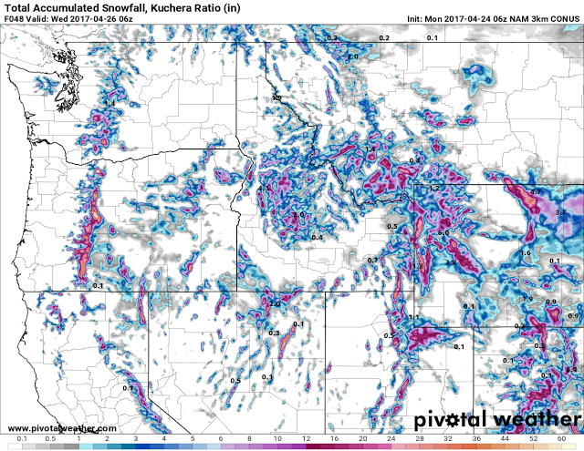
Model Forecast Snowfall from Monday morning through Tuesday Evening.
Zoom imagery over the same area as above showing upwards of two feet in the very
mountain ranges of Western Wyoming.
Total model forecast precipitation Monday morning through Tuesday evening.
Zoom imagery of the same area as above showing upwards of 2 plus inches
of precipitation over the higher mountains.