URGENT - WINTER WEATHER MESSAGE
National Weather Service Riverton WY
925 PM MDT Tue Apr 25 2017

...MORE SNOW RETURNING TO WESTERN WYOMING...

.After a lull in the snow late tonight and tomorrow morning,
another approaching Pacific cold front will bring more snow from
Wednesday afternoon into Thursday.


Salt River and Wyoming Ranges-
925 PM MDT Tue Apr 25 2017

...WINTER WEATHER ADVISORY IN EFFECT FROM NOON WEDNESDAY TO NOON
MDT THURSDAY...

The National Weather Service in Riverton has issued a Winter
Weather Advisory for snow, which is in effect from noon Wednesday
to noon MDT Thursday.

* TIMING...Snow will become steadier and heavier tomorrow
  afternoon and continue into Thursday. The heaviest snow is
  expected later Wednesday night and Thursday morning.

* TOTAL SNOWFALL...5 to 9 inches.

* MAIN IMPACT...Highways will become slick, slushy or snow
  covered, including Salt Pass. Visibility could be reduced to
  under one half mile at times.


Jackson Hole-Star Valley-
Including the cities of Jackson, Afton, Alpine,
Star Valley Ranch, and Thayne
925 PM MDT Tue Apr 25 2017

...WINTER WEATHER ADVISORY IN EFFECT FROM 6 PM WEDNESDAY TO NOON
MDT THURSDAY...

The National Weather Service in Riverton has issued a Winter
Weather Advisory for snow, which is in effect from 6 PM Wednesday
to noon MDT Thursday.

* TIMING...A mix of rain and snow will change to snow Wednesday
  night and continue into Tuesday.

* TOTAL SNOW...2 to 5 inches.

* MAIN IMPACT...Highways will become slick, slushy or snow
  covered.
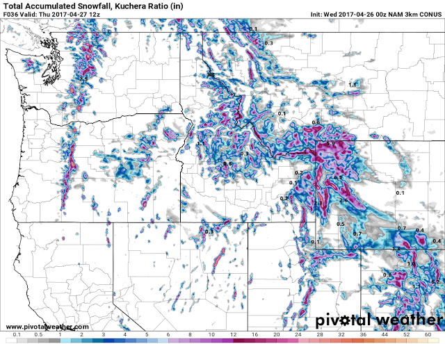
 |
| Model Snow Forecast Wednesday until Thursday Morning
Zoom Model Snow Forecast, same as above
|