 |
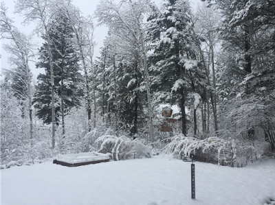
| 6 inches new snow at Star Valley Ranch |
National Weather Service Riverton WY
1300 PM MST Sun Nov 05 2017

...Snowfall Totals from the Weekend`s Winter Storm...

The following are snowfall amounts from 6 am Friday until noon on
Sunday for this weekend`s storm.

Observations are collected from a variety of sources with varying
equipment and exposures. We thank all volunteer weather observers
for their dedication. Not all data listed are considered official.

Location                              Snowfall
Lincoln County...
 Willow Creek Snotel...              23 inches.
 Commissary Ridge...                 18 inches.
 Blind Bull Summit Snotel...         18 inches.
 Blind Bull Summit...                18 inches.
 Spring Creek Divide Snotel...       17 inches.
 Indian Creek Snotel...              16 inches.
 Cottonwood Creek Snotel...          14 inches.
 5 NNE Thayne...                     10 inches.
 Salt River Summit Snotel...          9 inches.
 Smoot...                             7 inches.
 Box Y Ranch...                       7 inches.
 5 SSE Smoot...                       6 inches.
 Kelley Ranger Station Snotel...      5 inches.
 2 SE Thayne...                     4.8 inches.
 Star Valley Ranch...                 4 inches.
 Afton...                             3 inches.
 Hams Fork Snotel...                  2 inches.
 Fossil Butte...                      1 inch.

Park County...
 Beartooth Lake Snotel...            18 inches.
 Evening Star Snotel...              14 inches.
 Blackwater Snotel...                13 inches.
 Pahaska...                           7 inches.
 Kirwin Snotel...                     6 inches.
 26 SW Cody...                        6 inches.
 Marquette Snotel...                  4 inches.
 Younts Peak Snotel...                3 inches.
 Cody...                     1.5 to 2.5 inches.
 2 WSW Cody...                        2 inches.
 3 NE Sunshine...                   1.3 inches.
 4 SE Cody...                       1.1 inches.
 4 SW Powell...                     0.4 inches.
 4 ENE Powell...                    0.4 inches.


Big Horn County...
 Bald Mountain Snotel...              4 inches.
 Shell Creek Snotel...                3 inches.
 9 NNW Shell...                     2.4 inches.
 Bone Springs Divide Snotel...        2 inches.
 9 ENE Greybull...                  0.9 inches.
 2 SSW Lovell...                    0.5 inches.

Fremont County...
 Hobbs Park Snotel...                14 inches.
 Deer Park Snotel...                 10 inches.
 Burroughs Creek Snotel...            9 inches.
 Little Warm Snotel...                6 inches.
 Brooks Lake...                       5 inches.
 South Pass Snotel...                 5 inches.
 Cold Springs Snotel...               3 inches.
 Townsend Creek Snotel...             2 inches.
 Castle Creek Snotel...               1 inch.
 Atlantic City...                   0.9 inches.
 6 SW Lander...                     0.5 inches.
 Dubois...                          0.2 inches.
 Riverton Airport...                0.1 inches.

Hot Springs County...
 Owl Creek Snotel...                  1 inch.
 9 NE Thermopolis...                0.1 inches.

Johnson County...
 Cloud Peak Reservoir Snotel...       3 inches.
 4 SSW Buffalo...                   2.5 inches.
 13 SSE Buffalo...                  2.5 inches.
 17 NNW Kaycee...                   1.5 inches.

Sublette County...
 Triple Peak Snotel...               18 inches.
 Loomis Park Snotel...               11 inches.
 Pocket Creek Snotel...               7 inches.
 Gunsite Pass Snotel...               7 inches.
 Snider Basin Snotel...               6 inches.
 Big Sandy Opening Snotel...          6 inches.
 Larsen Creek Snotel...               5 inches.
 Bondurant...                       4.6 inches.
 East Rim Divide Snotel...            4 inches.
 Kendall Ranger Station Snotel...     3 inches.
 Elkhart Park G.S. Snotel...          2 inches.
 New Fork Lake Snotel...              2 inches.
 14 NW Pinedale...                  1.3 inches.
 Boulder Rearing Station...           1 inch.
 Pinedale...                        0.4 inches.

Sweetwater County...
 7 SE Rock Springs...               0.7 inches.
 Green River...              0.3 to 0.5 inches.
 4 NNW Rock Springs...              0.4 inches.

Teton County...
 Grand Targhee Snotel...             22 inches.
 Jackson Hole - Raymer...            19 inches.
 Jackson Hole - Rendezvous Bowl...   16 inches.
 Grand Targhee - Chief Joseph...     15 inches.
 Jackson Hole - Mid Mountain...      15 inches.
 Togwotee Pass Snotel...             15 inches.
 Base Camp Snotel...                 13 inches.
 Gros Ventre Summit Snotel...         9 inches.
 Phillips Bench Snotel...             9 inches.
 Togwotee Mountain Lodge...           7 inches.
 1 NNW Alta...                        4 inches.
 Darwin Ranch...                      4 inches.
 Snake River Stn Snotel...            4 inches.
 3 SSW Wilson...                      3 inches.
 Snow King...                         2 inches.
 Jackson Dam...                     1.5 inches.
 Granite Creek Snotel...              1 inch.
 Jackson...                         0.2 inches.

Washakie County...
 Powder River Pass Snotel...          4 inches.
 5 NNW Ten Sleep...                 2.4 inches.
 Ten Sleep...                       1.5 inches.
 16 SSE Ten Sleep...                1.2 inches.
 27 S Ten Sleep...                  0.6 inches.
 Winchester...                      0.5 inches.
 8 SW Worland...                    0.5 inches.

Yellowstone National Park...
 Lewis Lake Divide Snotel...         23 inches.
 Two Ocean Plateau Snotel...         21 inches.
 Thumb Divide Snotel...              15 inches.
 Parker Peak Snotel...               14 inches.
 Sylvan Lake Snotel...               14 inches.
 Canyon Snotel...                    13 inches.
 Yellowstone East Entrance...         7 inches.
 Sylvan Road Snotel...                4 inches.

