National Weather Service Riverton WY
332 PM MST Thu Dec 21 2017

...Snow returns across the west to kick off Christmas Weekend...

.An Arctic front will bring a fresh round of snow across the west
Friday. Snow will start late tonight over Yellowstone and spread
southward through the day. Snow will then taper off through the
morning hours on Saturday, with lingering showers possible in the
afternoon.
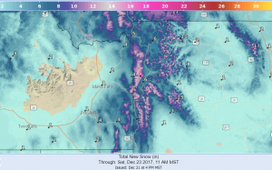
Forecast Snowfall to Noon Saturday December 23 2017
...WINTER STORM WARNING IN EFFECT FROM 5 AM FRIDAY TO NOON MST
SATURDAY...

* WHAT...Heavy snow and blowing snow expected. Plan on difficult
  travel conditions, including during the evening commute on
  Friday. Total snow accumulations of 7 to 10 inches, with
  localized amounts up to 17 inches, are expected.

* WHERE...Teton and Gros Ventre Mountains.

* WHEN...5 AM Friday to noon Saturday.

* ADDITIONAL DETAILS...Winds gusting as high as 30 mph will
  cause patchy blowing and drifting snow.
Wind River Mountains West-Star Valley-
Salt River and Wyoming Ranges-Upper Green River Basin Foothills-
Including the cities of Afton, Alpine, Star Valley Ranch, Thayne,
and Pinedale

...WINTER WEATHER ADVISORY IN EFFECT FROM 2 PM FRIDAY TO 5 PM MST
SATURDAY...

* WHAT...Snow and blowing snow expected. Plan on difficult travel
  conditions. Total snow accumulations of 3 to 5 inches near
  Pinedale and Bondurant, 3 to 6 inches, locally up to 8 inches in
  the Star Valley, 6 to 12 inches, with localized amounts up to 15
  inches, in the Wind River Mountains and Salt and Wyoming Ranges are
  expected.

* WHERE...Wind River Mountains West, Star Valley, Salt River and
  Wyoming Ranges and Upper Green River Basin Foothills.

* WHEN...2 PM Friday to 5 PM Saturday.

* ADDITIONAL DETAILS...Winds gusting as high as 40 mph will
  cause patchy blowing and drifting snow.