Porcupine Slide Decision Support Page
The Riverton Forecast Office has established a Decision Support page to provide environmental information for the Porcupine Slide area along the Greys River. Included are current forecasts and observations for the area.
Following is the link for the page
https://www.weather.gov/riw/PorcupineSlideDSS
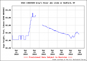
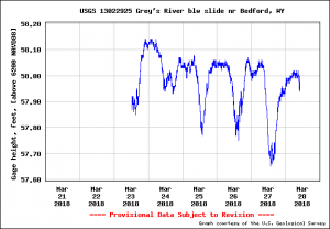
Of particular interest are two river gauges both above and below the slide.
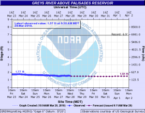
In addition there is also a river gauge located at the mouth of the Greys where it enters the Snake River
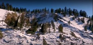
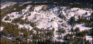
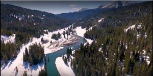
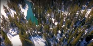
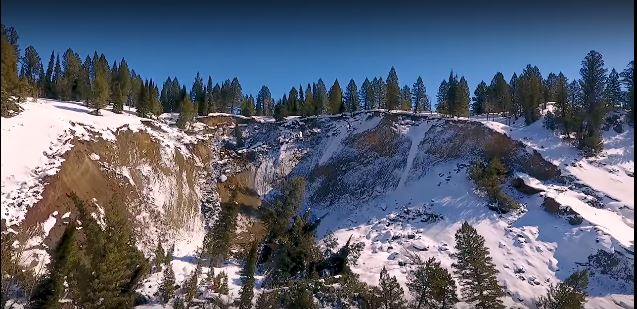
ON MARCH 9TH AN AERIAL VIDEO OF THE PORCUPINE CREEK LANDSLIDE ALONG THE GREYS RIVER IN THE BRIDGER-TETON NATIONAL FOREST WAS PROVIDED BY CONTOUR AERIALS.
Following is the link to the full drone flight over the slide area
From the drone flight are a series of photos which follow: