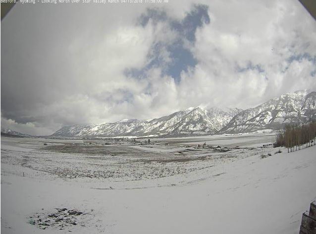
Bedford Cam looking north toward Star Valley Ranch
National Weather Service Riverton WY
0547 AM MST Fri Apr 13 2018

...Preliminary Peak Wind Gusts and Snowfall Totals...

...Snowfall Totals from Wednesday night through Thursday night...

Observations are collected from a variety of sources with varying
equipment and exposures. We thank all volunteer weather observers
for their dedication. Not all data listed are considered official.

Note: SnoTELS (Snow Telemetry) are remote sensing sites in high
mountain watersheds. Snowfall data from SNOTELS are estimated based
on snow water equivalent.

Location                              Snowfall

Big Horn County...
 Bone Springs Divide Snotel...        5 inches.
 Bald Mountain Snotel...              4 inches.
 Shell Creek Snotel...                2 inches.

Fremont County...
 Brooks Lake...                       9 inches.
 Little Warm Snotel...                3 inches.
 10 NW Riverton...                    3 inches.
 Cold Springs Snotel...               3 inches.
 Burroughs Creek Snotel...            2 inches.
 Castle Creek Snotel...               2 inches.
 Riverton Airport...                  1 inch.

Hot Springs County...
 Owl Creek Snotel...                  5 inches.

Johnson County...
 Little Goose Snotel...               4 inches.
 Cloud Peak Reservoir Snotel...       2 inches.
 Soldier Park Snotel...               1 inch.

Lincoln County...
 Willow Creek Snotel...              12 inches.
 Cottonwood Creek Snotel...           8 inches.
 Indian Creek Snotel...               8 inches.
 Blind Bull Summit Snotel...          4 inches.
 Kelley Ranger Station Snotel...      4 inches.
 Salt River Summit Snotel...          3 inches.
 Spring Creek Divide Snotel...        3 inches.
 Commissary Ridge...                  3 inches.
 5 SSE Smoot...                       3 inches
 Star Valley Ranch...               2.5 inches.
 1.5 SE Thayne...                   2.5 inches
 Blind Bull Summit...                 2 inches.
 Hams Fork Snotel...                  2 inches.
 Fossil Butte...                    1.5 inches.


Park County...
 Blackwater Snotel...                 4 inches.
 Beartooth Lake Snotel...             4 inches.
 Kirwin Snotel...                     3 inches.
 Evening Star Snotel...               2 inches.
 Marquette Snotel...                  2 inches.
 Wolverine Snotel...                  2 inches.
 Younts Peak Snotel...                1 inch.
 26 SW Cody...                      0.2 inches.
 Pahaska...                         0.2 inches.

Sublette County...
 Triple Peak Snotel...                3 inches.
 Pocket Creek Snotel...               2 inches.
 Gunsite Pass Snotel...               2 inches.
 Snider Basin Snotel...               2 inches.
 East Rim Divide Snotel...            1 inch.

Teton County...
 Grand Targhee Snotel...             18 inches.
 Phillips Bench Snotel...            12 inches.
 Jackson Hole - Raymer...            10 inches.
 Grassy Lake Snotel...                8 inches.
 Jackson Hole - Mid Mountain...       8 inches.
 Colter Bay...                        6 inches.
 Snake River Stn Snotel...            6 inches.
 Base Camp Snotel...                  6 inches.
 Togwotee Pass Snotel...              6 inches.
 Jackson Dam...                     5.8 inches.
 Togwotee Mountain Lodge...           5 inches.
 Snow King...                         4 inches.
 12 NE Jackson...                     4 inches.
 Moose...                           3.2 inches.
 Grand Targhee - Chief Joseph...      3 inches.
 3 SSW Wilson...                      3 inches.
 5 NW Jackson...                    1.7 inches.
 Darwin Ranch...                      1 inch.

Washakie County...
 Powder River Pass Snotel...          3 inches.
 Middle Powder Snotel...              1 inch.

Yellowstone National Park...
 Two Ocean Plateau Snotel...          9 inches.
 Lewis Lake Divide Snotel...          9 inches.
 Sylvan Road Snotel...                7 inches.
 Sylvan Lake Snotel...                7 inches.
 Canyon Snotel...                     6 inches.
 Thumb Divide Snotel...               5 inches.
 Parker Peak Snotel...                5 inches.

...Wind Reports over the past 48 hours...

Location                     Speed     Time/Date     Elevation (ft.)

...Big Horn County...
17 E Lovell                  46 MPH    0200 AM 04/13   5421
Cowley Airport               45 MPH    1035 PM 04/12   4090

...Fremont County...
Red Canyon                   67 MPH    0900 AM 04/11   6768
Beaver Rim                   62 MPH    1016 AM 04/11   6784
10 W Fort Washakie           58 MPH    1101 AM 04/11   9235
7 NW Lander                  55 MPH    0905 PM 04/12   5797
3 NNW Hudson                 54 MPH    1246 PM 04/11   5555
8 W South Pass City          52 MPH    1150 AM 04/12   8120
Jeffrey City                 51 MPH    1114 AM 04/11   6374
Riverton Airport             48 MPH    0129 PM 04/11   5525
Crowheart                    47 MPH    0543 PM 04/12   6099
3 S Togwotee Pass            47 MPH    0900 AM 04/11   10430
Lander Airport               46 MPH    1210 PM 04/12   5586
10 N Dubois                  45 MPH    0957 AM 04/11   8085

...Hot Springs County...
10 S Meeteetse               61 MPH    1042 AM 04/11   7127
9 WNW Thermopolis            52 MPH    0950 AM 04/11   4902
Thermopolis                  49 MPH    1040 AM 04/11   4426

...Johnson County...
Kaycee                       50 MPH    1055 AM 04/11   4681
7 SW Barnum                  49 MPH    0946 PM 04/12   6440
25 ESE Buffalo               49 MPH    0510 AM 04/13   4657
18 NW Buffalo                48 MPH    1047 AM 04/11   8604
5 ESE Story                  47 MPH    0441 AM 04/13   4673
Buffalo Airport              46 MPH    0337 AM 04/13   4970

...Lincoln County...
13 W Kemmerer                52 MPH    0520 PM 04/12   6718

...Natrona County...
20 N Casper                  52 MPH    1121 AM 04/11   5677
16 S Hiland                  52 MPH    0110 PM 04/11   6380
8 S Casper                   49 MPH    0352 PM 04/12   7740
Natrona                      48 MPH    0115 PM 04/11   5589
7 W Alcova                   47 MPH    1205 PM 04/11   6342
Casper Outer Drive           47 MPH    0246 PM 04/12   5463
Casper Airport               45 MPH    0136 PM 04/11   5320
2 SE Hiland                  45 MPH    1240 PM 04/11   6134
13 S Casper                  45 MPH    0301 PM 04/12   6830

...Park County...
Hoyt Peak                    66 MPH    1030 AM 04/11   9800
Chief Joseph Hwy             62 MPH    0815 AM 04/11   8136
5 WNW Clark                  54 MPH    0648 AM 04/11   4659
10 WNW Cody                  54 MPH    0740 AM 04/11   8401
8 N Meeteetse                49 MPH    1016 AM 04/11   5926
2 WSW Cody                   45 MPH    1000 AM 04/11   5167

...Sublette County...
21 W Big Piney               49 MPH    0709 PM 04/12   8200

...Sweetwater County...
I 80 - Mile Marker 142       57 MPH    1210 PM 04/12   7162
15 SE Rock Springs           54 MPH    1244 PM 04/12   7550
6 WSW Rock Springs           54 MPH    1045 AM 04/12   6212
Rock Springs Airport         52 MPH    1042 AM 04/12   6760
7 WSW Rock Springs           52 MPH    1045 AM 04/12   6238
I 80 - Mile Marker 184       50 MPH    1201 PM 04/12   7112
5 E Rock Springs             50 MPH    1105 AM 04/12   6369
9 WNW Green River            49 MPH    1015 AM 04/12   6290
I 80 - Mile Marker 157       49 MPH    1145 AM 04/12   6965
3 NW Rock Springs            45 MPH    1104 AM 04/12   6458
I 80 - Mile Marker 124       45 MPH    1116 AM 04/12   6475
I 80 - Mile Marker 131       45 MPH    1131 AM 04/12   6636

...Teton County...
Summit - Jackson Resort      54 MPH    0815 AM 04/11   10318

...Washakie County...
15 SSW Big Trails            53 MPH    1040 AM 04/11   6554