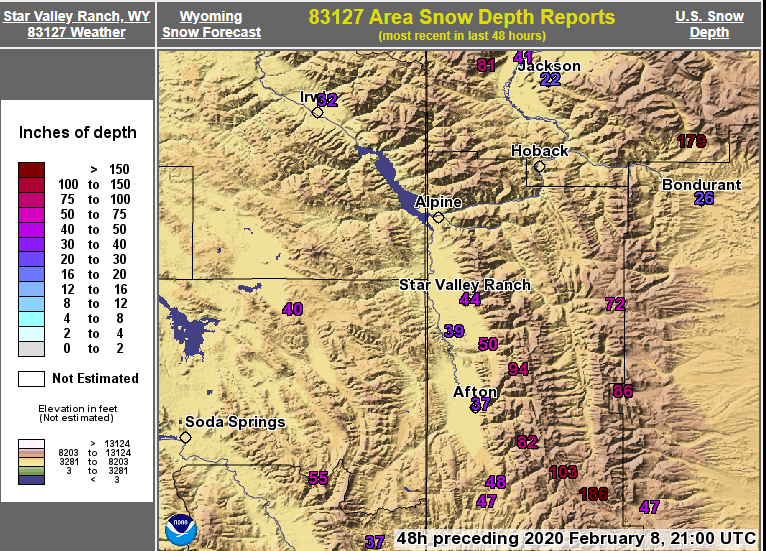
Snow Fall Totals for Wednesday through Friday Storm
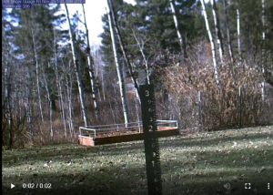
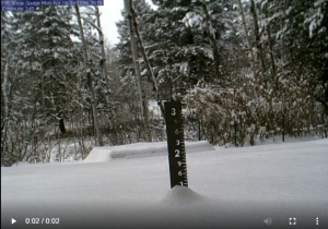
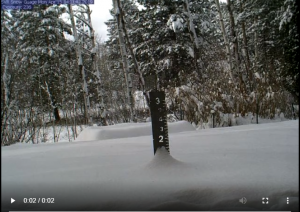
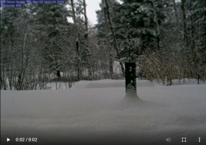
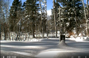
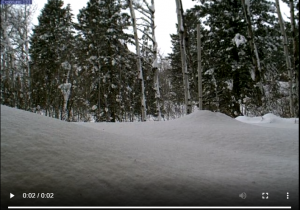
National Weather Service Riverton WY
1113 AM MDT Sat Feb 8 2020

Here are the Final Snowfall Totals for the snow event that began
Wednesday night and ended early Friday afternoon. The most snow
fell in the west with very impressive snow totals.  We thank our
observers and spotters for their dedication to provide their snow
reports.

Note: SNOTELS (Snow Telemetry) are remote sensing sites in high
mountain watersheds. Snowfall data from SNOTELS are estimated based
on snow water equivalent.

*** ENTER EVENT TEXT HERE ***

Location                              Snowfall

Big Horn County...
 Bald Mountain Snotel...              9 inches.
 Deaver...                          5.5 inches.
 Bone Springs Divide Snotel...        5 inches.
 2 SSW Lovell...                    4.7 inches.
 9 ENE Greybull...                  4.5 inches.
 Cowley...                          3.5 inches.
 Shell Creek Snotel...                3 inches.
 Basin...                             3 inches.

Fremont County...
 Brooks Lake...                      18 inches.
 Townsend Creek Snotel...             4 inches.
 Hudson...                          3.5 inches.
 Burroughs Creek Snotel...            3 inches.
 Little Warm Snotel...                3 inches.
 Boysen Dam...                      2.5 inches.
 South Pass Snotel...                 2 inches.
 Deer Park Snotel...                  2 inches.
 Atlantic City...                     2 inches.
 9 SSE Lander...                      2 inches.
 9 SSE Lander...                    1.7 inches.
 6 SW Lander...                     1.3 inches.
 1 N Lander...                        1 inch.
 4 WSW Lander...                      1 inch.
 Riverton...                   0.5 to 1 inch.
 7 WNW Lander...                    0.8 inches.
 Shoshoni...                        0.7 inches.
 Riverton Airport...                0.6 inches.
 Dubois...                          0.5 inches.

Hot Springs County...
 Lucerne...                         5.2 inches.
 6 N Thermopolis...                   5 inches.
 9 NE Thermopolis...                3.8 inches.
 Kirby...                           3.2 inches.
 Thermopolis...                       3 inches.
 11 WNW Thermopolis...              1.5 inches.
 Owl Creek Snotel...                  1 inch.

Johnson County...
 Buffalo...                         4.8 inches.
 Little Goose Snotel...              4 inches.
 Cloud Peak Reservoir Snotel...      4 inches.
 Soldier Park Snotel...              3 inches.
 Buffalo...                         2.8 inches.
 1 SW Buffalo...                      2 inches.
 Bear Trap Meadow Snotel...          2 inches.
 4 SSW Buffalo...                   1.7 inches.
 Buffalo...                         1.6 inches.
 13 SSE Buffalo...                  0.5 inches.

Lincoln County...
 Commissary Ridge...                 27 inches.
 Star Valley Ranch                   26.5 inches.
 Alpine...                           26 inches.
 Spring Creek Divide Snotel...       26 inches.
 Willow Creek Snotel...              25 inches.
 2 SE Thayne...                      23 inches.
 Blind Bull Summit...                22 inches.
 5 SSE Smoot...                      21 inches.
 Star Valley Ranch...              20.7 inches.
 Cottonwood Creek Snotel...          19 inches.
 3 SE Bedford...                     18 inches.
 Box Y Ranch...                      17 inches.
 Afton...                          15.1 inches.
 Indian Creek Snotel...              15 inches.
 Hams Fork Snotel...                 12 inches.
 Salt River Summit Snotel...         12 inches.
 Blind Bull Summit Snotel...         11 inches.
 Kelley Ranger Station Snotel...      9 inches.
 Fossil Butte...                    2.7 inches.

Natrona County...
 Reno Hill Snotel...                 12 inches.
 Grave Springs Snotel...              6 inches.
 Casper Mountain Snotel...            5 inches.
 1 SW Casper...                     4.5 inches.
 5 SSW Casper...                    4.5 inches.
 Casper...                     1.5 to 3 inches.
 Casper Airport...                  2.8 inches.
 4 WSW Casper...                    2.7 inches.
 10 WSW Casper...                   2.5 inches.
 18 SW Casper...                    1.5 inches.

Park County...
 Clark...                          10.5 inches.
 3 NE Clark...                       10 inches.
 Powell...                       6 to 8 inches.
 Blackwater Snotel...                 7 inches.
 4 ENE Powell...                    6.3 inches.
 Younts Peak Snotel...                6 inches.
 4 SW Powell...                       5 inches.
 Beartooth Lake Snotel...             4 inches.
 Evening Star Snotel...               4 inches.
 1 N Powell...                      3.5 inches.
 3 NE Sunshine...                   3.3 inches.
 Pahaska...                           3 inches.
 2 WSW Cody...                        3 inches.
 Timber Creek Snotel...               2 inches.
 Kirwin Snotel...                     2 inches.
 Cody...                       1 to 1.8 inches.
 4 SE Cody...                       0.6 inches.

Sublette County...
 Triple Peak Snotel...               25 inches.
 Snider Basin Snotel...              13 inches.
 14 NW Pinedale...                  9.3 inches.
 Loomis Park Snotel...                9 inches.
 East Rim Divide Snotel...            8 inches.
 Merna...                           6.5 inches.
 Bondurant...                         6 inches.
 Gunsite Pass Snotel...               5 inches.
 Elkhart Park G.S. Snotel...          5 inches.
 Kendall Ranger Station Snotel...     4 inches.
 Big Sandy Opening Snotel...          3 inches.
 1 E Pinedale...                    2.7 inches.
 Larsen Creek Snotel...               2 inches.
 Daniel Fish Hatchery...              1 inch.
 Boulder Rearing Station...           1 inch.
 New Fork Lake Snotel...              1 inch.

Sweetwater County...
 Wamsutter...                         4 inches.
 2 NNE Farson...                      1 inch.

Teton County...
 Jackson Hole - Mid Mountain...      30 inches.
 Jackson Hole - Raymer...            28 inches.
 Jackson Hole - Rendezvous Bowl...   26 inches.
 2 NE Teton Village...             20.3 inches.
 Jackson Hole - Base...              20 inches.
 Togwotee Pass Snotel...             18 inches.
 3 SSW Wilson...                     17 inches.
 Grassy Lake Snotel...               16 inches.
 Togwotee Mountain Lodge...          16 inches.
 5 NW Jackson...                     16 inches.
 Moose...                            15 inches.
 Grand Targhee - Chief Joseph...     14 inches.
 Grand Targhee Snotel...             13 inches.
 Phillips Bench Snotel...            13 inches.
 Gros Ventre Summit Snotel...        11 inches.
 Snow King...                        10 inches.
 Jackson Dam...                     8.5 inches.
 1 NNW Alta...                        8 inches.
 Base Camp Snotel...                  8 inches.
 Jackson...                           8 inches.
 Darwin Ranch...                    7.5 inches.
 6 NW Moose...                        6 inches.
 Granite Creek Snotel...              5 inches.
 Snake River Stn Snotel...            5 inches.
 12 NE Jackson...                     3 inches.

Washakie County...
 Middle Powder Snotel...              8 inches.
 5 NNW Ten Sleep...                 4.1 inches.
 16 SSE Ten Sleep...                  4 inches.
 Powder River Pass Snotel...          4 inches.
 8 SW Worland...                      4 inches.
 Winchester...                      3.5 inches.
 Ten Sleep...                       3.1 inches.
 9 N Worland...                       2 inches.
 4 N Ten Sleep...                   1.5 inches.
 Ten Sleep...                         1 inch.
 Worland...                      1 to 2 inches.

Yellowstone National Park...
 Parker Peak Snotel...               14 inches.
 Tower Falls Ranger Station...     11.5 inches.
 Two Ocean Plateau Snotel...         11 inches.
 Snake River Ranger Station...      9.5 inches.
 Lamar Ranger Station...            8.3 inches.
 Sylvan Lake Snotel...                7 inches.
 Lewis Lake Divide Snotel...          6 inches.
 Canyon Snotel...                     6 inches.
 Thumb Divide Snotel...               4 inches.
 Sylvan Road Snotel...                4 inches.
 Yellowstone East Entrance...         3 inches.
 Northeast Entrance Ranger Station... 1 inch.

Observations are collected from a variety of sources with varying
equipment and exposures. We thank all volunteer weather observers
for their dedication. Not all data listed are considered official.

Following are a series of cam photos of the Star Valley Ranch Snow Stake this Winter: