SNOW!
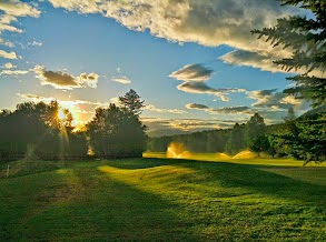
There may be a temporary setback to the current fine Spring weather that Star Valley has experienced so far this month. While the following photo was taken of Cedar Creek golf course at Star Valley Ranch Saturday evening

there could be a scene like this by Wednesday morning in the nearby mountains.
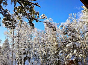
While the mountains are most likely to experience this picture, even in Star Valley at least some wet snow could occur in showers that fall Tuesday into Wednesday morning.
The culprit in this setback is the low pressure trough now approaching the Pacific Northwest which will develop southeastward as the large high pressure ridge moves into the northeastern Pacific Ocean.
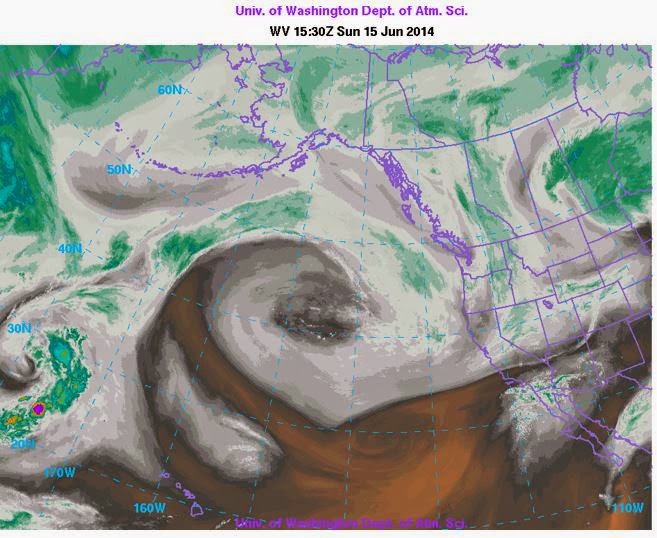 |
| WV Imagery Sunday AM 6/15/2014
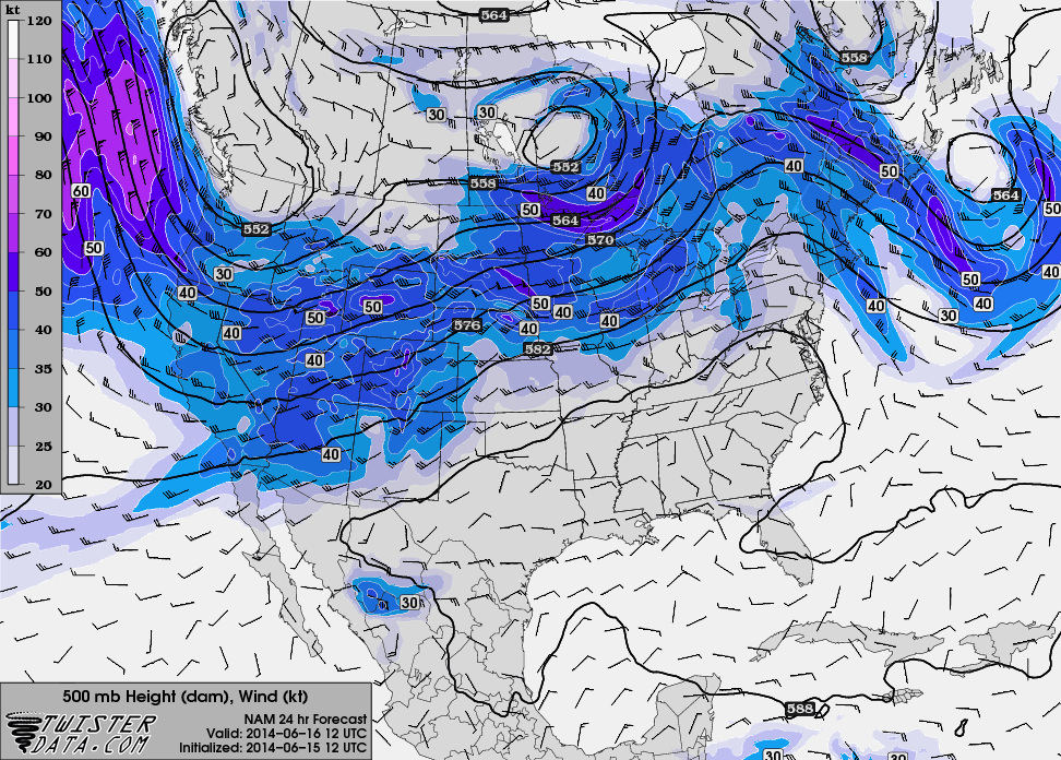
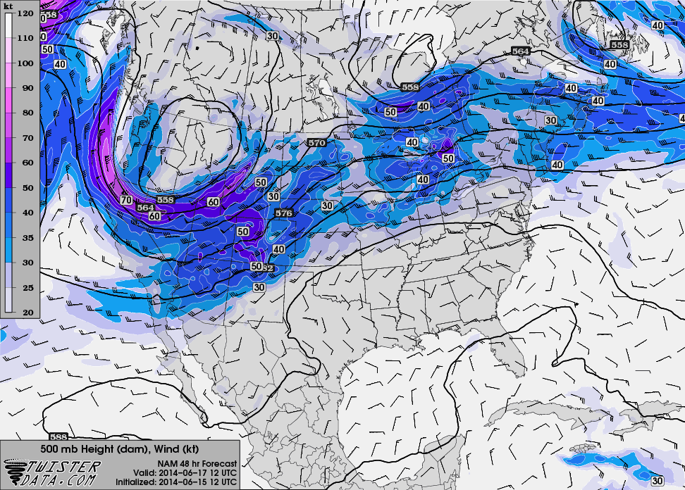
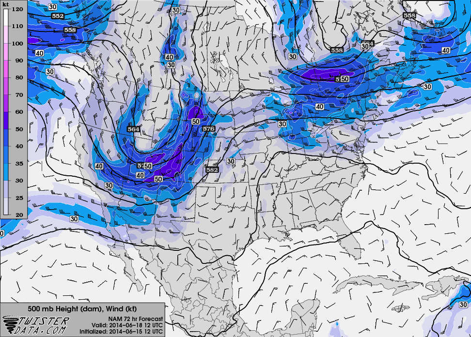
A sequence of 500 mb forecast charts illustrates the develop of the upper low pressure toward Wyoming by midweek.
|

The forecast precipitation for the next 3 days through Wednesday morning indicates that significant amounts could occur in much of western Wyoming, particularly in the vicinity of Yellowstone NP.

Finally the following is a forecast sounding over Star Valley for Wednesday at sunrise
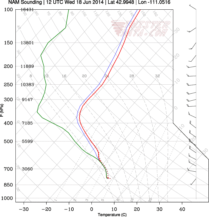
This sounding supports snowfall down to the valley floor in western Wyoming, including Star Valley.