
Snow and Possibly Rain Return to Star Valley
After a basically snowless two weeks the later half of January, Star Valley is seeing to a return of more typical mid-winter conditions. Snow is being reported from much of Northwest Wyoming including Star Valley this Sunday evening. A flow of moist Pacific air has spread across the Pacific Northwest into northwest Wyoming, and will continue for the next 3 days. The real question is where will the snow level be at during the event as the air mass is relatively warm for February.
There is considerable confidence that substantial precipitation will occur from Star Valley northward to Yellowstone Park with a couple feet of snow in the higher mountains. The latest computer model forecast precipitation for the next 3 days clearly focuses the precipitation in this area.
 |
| 72 Hour total precipitation ending Wednesday evening Feb 4 2015 |
The 500mb wind pattern shows the flow from off the Pacific with the cold air remaining well to the north and east of Western Wyoming.
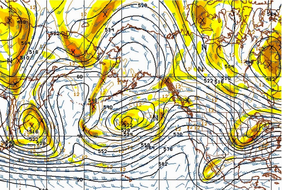 |
| 500mb analysis Sunday evening Feb 1 2015
|
A forecast of the vertical profile of temperature and moisture over Star Valley for Tuesday evening show the deep moisture and strong westerly flow, along with the freezing level about 7500 feet.
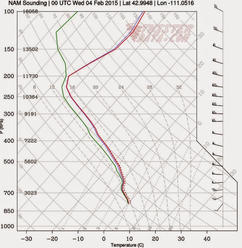 |
| model sounding over Star Valley Tue pm Feb 3 2015 |
This moist and relatively warm profile support snow either mixing with rain at times or possibly turning to rain over the next 3 days. Nevertheless there is potential for significant amount of wet snow, particularly higher elevations of the Valley, near or above 6500 feet.
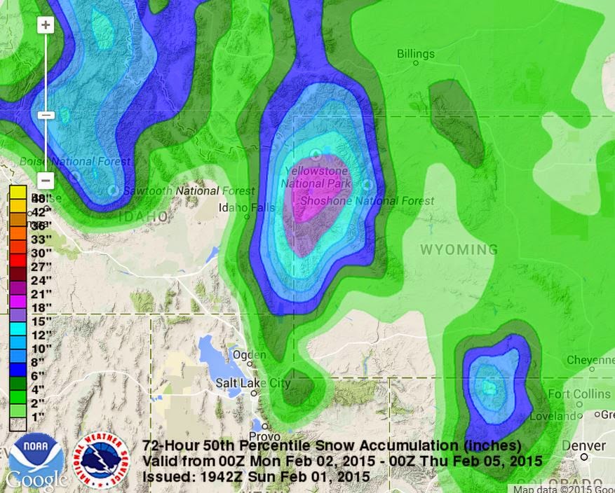
The NWS forecasters at the Weather Prediction Center provide a 72 hour accumulation of snow ending Wednesday evening. They are predicting a 50 percent chance of well over a foot in the higher elevations from Star Valley to Yellowstone NP. Near 2 feet is being forecast for locations such as the Tetons and possibly the northern Wyoming and Salt Ranges as well.
 |