Cloud Cover Forecast for the Eclipse Path on Monday August 21 2017
As of mid day Wednesday, it is just 5 days before the much anticipated Total Solar Eclipse will be tracking across Wyoming. While forecasting cloud cover is risky at best 5 days in advance most places, the numerical models are now within range to begin having some skill to do so.
Climatology would suggest that the morning hours(time of the eclipse event) would have the best chance of minimal clouds. Typically cumulus develop over and near the mountains by late morning, leading to the possibility of thunderstorms during the afternoon hours.
The GFS model which is the primary forecast model for the United States produces a new forecast every 6 hours which extends out for 384 hours. Thus it produces a new cloud cover forecast for the time of the eclipse every 6 hours.
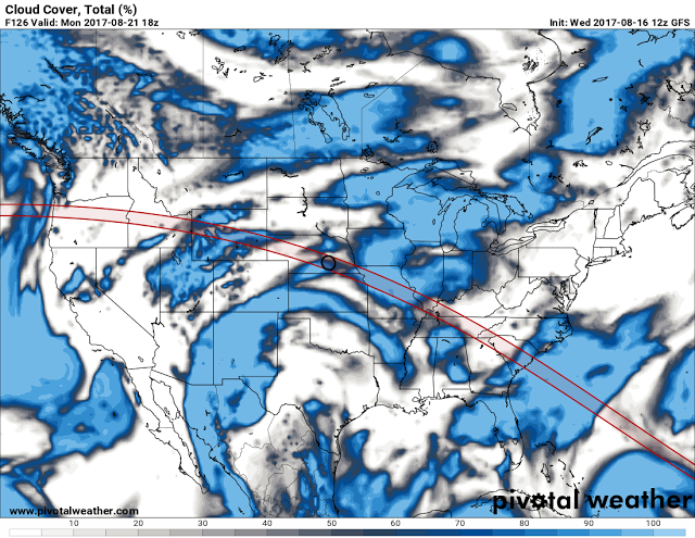
Below is the forecast cloud cover from the GFS model generated at noon Wednesday for mid day on Monday over the U.S.
 |
| Cloud Cover Total (%) valid at Noon Monday August 21 2017
This forecast suggests that the area from Oregon into Idaho has a good chance of favorable eclipse viewing conditions, with some concern for cloud cover over much of Wyoming.
Again this is still 5 days out, and forecasting cloud cover is little better than a crap shoot at that range.
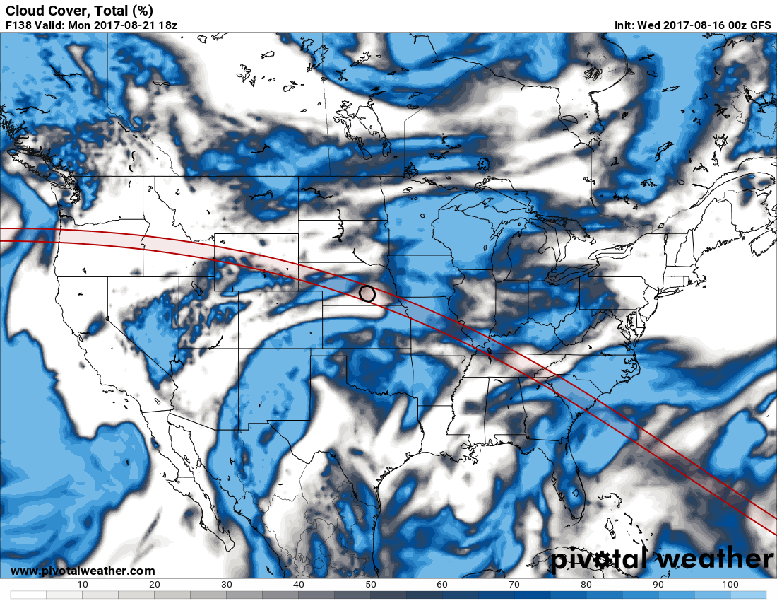
Below is the model forecast from 24 hours earlier for the eclipse time of noon Monday.
 |