Day 3 Eclipse Cloud Forecast
All the models that were run this Friday morning suggest that there is still a concern that clouds could be a factor in eclipse viewing on Monday. At this time it appears that the clouds will be primarily higher clouds and likely not completely block the sun as the Eclipse tracks across Southern Idaho and Wyoming around mid day.
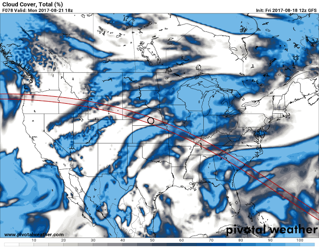
The first cloud forecast for noon Monday is from the GFS that was run this morning.
 |
| Forecast of percentage sky cover for noon Monday from the GFS Model |
Fortunately skill levels in forecasting cloud cover 3 days in advance is unreliable, as the band of clouds across Southeastern Idaho and Northwest Wyoming could be an issue for ideal eclipse viewing.
The GEFS forecast which is an ensemble of 20 different model solutions each starting with slightly different initial conditions, is more optimistic. Some cloudiness would be present,but not as solid as the GFS.
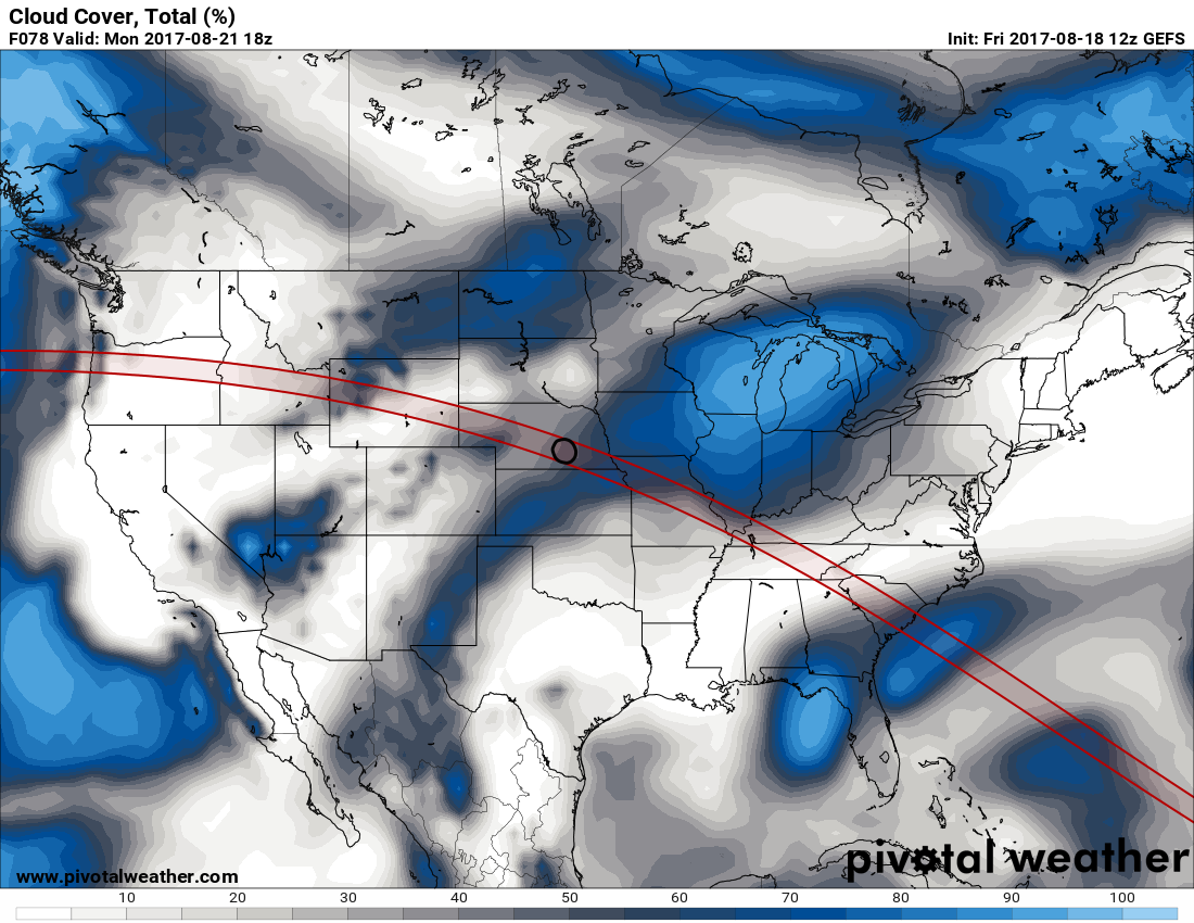 |
| GEFS forecast of percentage cloud cover for Noon Monday |
A third model the NAM is similar to the GFS with a band of clouds across Southeastern Idaho and Northwest Wyoming.
 |
| NAM forecast of percentage cloud cover at Noon Monday 8/21/17 |
The next chart is the GFS model forecast relative humidity at the 300 MB level, or around 30.000 feet. The band of high humidity coincides with the cloud cover forecast at that time.
 |
| Forecast of 300 MB humidity at Noon Monday.
The next chart is the forecast relative humidity at 700 MB, or about 10,000 above sea level. This suggest that moisture for clouds will be above 700 MB and most likely at the cirrus level.
All these forecast suggest a concern for at least high level cirrus and possibly some clouds at mid levels. Thus there remains a concern for at least some clouds to deal with during the Eclipse, but some three days ahead, forecasting cloud cover is still very difficult
 |