Snow and Cold Mostly north of Star Valley New Years Weekend
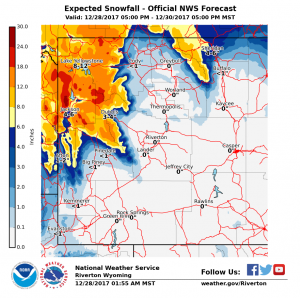
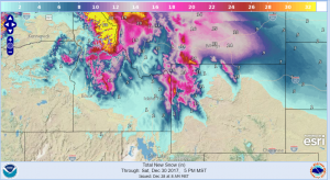
A winter storm will begin impacting northwest Wyoming Thursday night with periods of moderate to heavy snow Friday. The snow is expected to continue into Saturday. Significant snowfall is possible across the higher terrain of Yellowstone National Park and nearby areas of the Teton and Absaroka ranges. Storm totals could easily top one foot in many mountain locations.
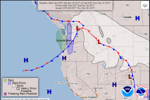
This storm systems primary impact will be to the north of Star Valley into Montana where a much colder air mass is currently located. Following are the expected weather maps for both Friday and Saturday indicating the important frontal and pressure centers and accompanying winter weather.
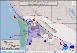
With the primary storm effects to the north and temperatures remaining near/above freezing in the valleys of western Wyoming, accumulating snow is expected to be limited in Star Valley but impressive snow totals to the north in higher elevations.
Even greater storm totals will occur across western Montana and Northern Idaho
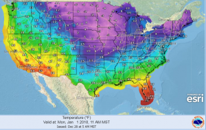
Bitterly cold arctic air will plunge southward to the east of the Continental Divide over the New Years weekend. The higher mountains to the east will protect Star Valley, thus temperatures should remain well above zero unlike further east across the plains.
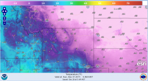
Looking ahead to New Years Day bitter cold is well entrenched east of the Continental Divide.