 Public Information Statement
National Weather Service Riverton WY
104 PM MST Tue May 01 2018
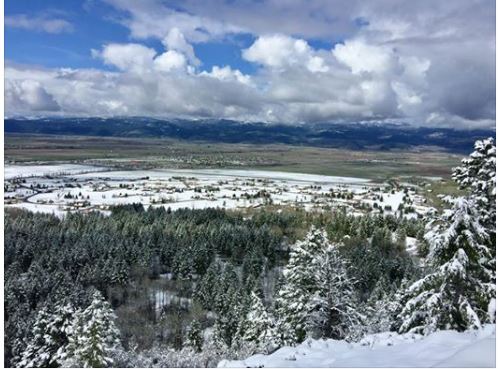
Final snowfall totals are in! This quick hitting spring storm
produced mostly rain in lower elevations east of the Divide, but
quite a few inches of snow fell in the mountains. Reports are
from Sunday night, through early this morning.
Observations are collected from a variety of sources with varying
equipment and exposures. We thank all volunteer weather observers
for their dedication. Not all data listed are considered official.
Note: SnoTELS (Snow Telemetry) are remote sensing sites in high
mountain watersheds. Snowfall data from SNOTELS are estimated based
on snow water equivalent.
Location Snowfall
Big Horn County...
Shell Creek Snotel... 7 inches.
Bald Mountain Snotel... 6 inches.
Bone Springs Divide Snotel... 3 inches.
Fremont County...
Deer Park Snotel... 17 inches.
South Pass Snotel... 12 inches.
Townsend Creek Snotel... 11 inches.
Brooks Lake... 8 inches.
Hobbs Park Snotel... 7 inches.
Cold Springs Snotel... 6 inches.
Burroughs Creek Snotel... 5 inches.
Castle Creek Snotel... 2 inches.
Dubois... 0.2 inches.
Hot Springs County...
Owl Creek Snotel... 8 inches.
Lucerne... 1 inch.
Johnson County...
Cloud Peak Reservoir Snotel... 7 inches.
Soldier Park Snotel... 6 inches.
Hansen Sawmill Snotel... 5 inches.
Little Goose Snotel... 5 inches.
Bear Trap Meadow Snotel... 2 inches.
Lincoln County...
Blind Bull Summit Snotel... 7 inches.
Kelley Ranger Station Snotel... 7 inches.
Willow Creek Snotel... 6 inches.
Salt River Summit Snotel... 6 inches.
Cottonwood Creek Snotel... 4 inches.
Indian Creek Snotel... 4 inches.
Spring Creek Divide Snotel... 3 inches.
2 SE Thayne... 3 inches.
Star Valley Ranch... 2 inches.
5 SSE Smoot... 2 inches.
5 NNE Thayne... 2 inches.
3 SE Bedford... 2 inches.
Afton... 1.7 inches.
Natrona County...
Grave Springs Snotel... 4 inches.
Park County...
Marquette Snotel... 14 inches.
Timber Creek Snotel... 9 inches.
Blackwater Snotel... 6 inches.
Kirwin Snotel... 4 inches.
Beartooth Lake Snotel... 3 inches.
Evening Star Snotel... 3 inches.
Wolverine Snotel... 2 inches.
3 NE Sunshine... 1.6 inches.
26 SW Cody... 0.5 inches.
Pahaska... 0.3 inches.
Meeteetse... 0.3 inches.
Sublette County...
Larsen Creek Snotel... 9 inches.
Big Sandy Opening Snotel... 7 inches.
East Rim Divide Snotel... 6 inches.
Pocket Creek Snotel... 6 inches.
New Fork Lake Snotel... 4 inches.
Triple Peak Snotel... 4 inches.
Pinedale... 3.7 inches.
Loomis Park Snotel... 3 inches.
Elkhart Park G.S. Snotel... 3 inches.
Kendall Ranger Station Snotel... 3 inches.
Pinedale... 3 inches.
Boulder Rearing Station... 3 inches.
14 NW Pinedale... 2.5 inches.
Gunsite Pass Snotel... 2 inches.
Snider Basin Snotel... 1 inch.
Sweetwater County...
Teton County...
Grand Targhee Snotel... 9 inches.
Togwotee Pass Snotel... 8 inches.
Grassy Lake Snotel... 8 inches.
Togwotee Mountain Lodge... 7 inches.
Jackson Hole - Rendezvous Bowl... 6 inches.
Colter Bay... 6 inches.
Snake River Stn Snotel... 6 inches.
Jackson Hole - Raymer... 5 inches.
1 NNW Alta... 5 inches.
Base Camp Snotel... 4 inches.
Jackson Hole - Mid Mountain... 4 inches.
Phillips Bench Snotel... 4 inches.
Granite Creek Snotel... 2 inches.
Gros Ventre Summit Snotel... 2 inches.
Darwin Ranch... 0.1 inches.
Washakie County...
Powder River Pass Snotel... 3 inches.
Yellowstone National Park...
Lewis Lake Divide Snotel... 6 inches.
Thumb Divide Snotel... 2 inches.
Sylvan Lake Snotel... 2 inches.
Yellowstone East Entrance... 1.5 inches.
Tower Falls Ranger Station... 1 inch.
Two Ocean Plateau Snotel... 1 inch.
$$
Public Information Statement
National Weather Service Riverton WY
104 PM MST Tue May 01 2018


Final snowfall totals are in!  This quick hitting spring storm
produced mostly rain in lower elevations east of the Divide, but
quite a few inches of snow fell in the mountains. Reports are
from Sunday night, through early this morning.

Observations are collected from a variety of sources with varying
equipment and exposures. We thank all volunteer weather observers
for their dedication. Not all data listed are considered official.

Note: SnoTELS (Snow Telemetry) are remote sensing sites in high
mountain watersheds. Snowfall data from SNOTELS are estimated based
on snow water equivalent.

Location                              Snowfall

Big Horn County...
 Shell Creek Snotel...                7 inches.
 Bald Mountain Snotel...              6 inches.
 Bone Springs Divide Snotel...        3 inches.

Fremont County...
 Deer Park Snotel...                 17 inches.
 South Pass Snotel...                12 inches.
 Townsend Creek Snotel...            11 inches.
 Brooks Lake...                       8 inches.
 Hobbs Park Snotel...                 7 inches.
 Cold Springs Snotel...               6 inches.
 Burroughs Creek Snotel...            5 inches.
 Castle Creek Snotel...               2 inches.
 Dubois...                          0.2 inches.

Hot Springs County...
 Owl Creek Snotel...                  8 inches.
 Lucerne...                           1 inch.

Johnson County...
 Cloud Peak Reservoir Snotel...       7 inches.
 Soldier Park Snotel...               6 inches.
 Hansen Sawmill Snotel...             5 inches.
 Little Goose Snotel...               5 inches.
 Bear Trap Meadow Snotel...           2 inches.

Lincoln County...
 Blind Bull Summit Snotel...          7 inches.
 Kelley Ranger Station Snotel...      7 inches.
 Willow Creek Snotel...               6 inches.
 Salt River Summit Snotel...          6 inches.
 Cottonwood Creek Snotel...           4 inches.
 Indian Creek Snotel...               4 inches.
 Spring Creek Divide Snotel...        3 inches.
 2 SE Thayne...                       3 inches.
 Star Valley Ranch...                 2 inches.
 5 SSE Smoot...                       2 inches.
 5 NNE Thayne...                      2 inches.
 3 SE Bedford...                      2 inches.
 Afton...                           1.7 inches.

Natrona County...
 Grave Springs Snotel...              4 inches.

Park County...
 Marquette Snotel...                 14 inches.
 Timber Creek Snotel...               9 inches.
 Blackwater Snotel...                 6 inches.
 Kirwin Snotel...                     4 inches.
 Beartooth Lake Snotel...             3 inches.
 Evening Star Snotel...               3 inches.
 Wolverine Snotel...                  2 inches.
 3 NE Sunshine...                   1.6 inches.
 26 SW Cody...                      0.5 inches.
 Pahaska...                         0.3 inches.
 Meeteetse...                       0.3 inches.

Sublette County...
 Larsen Creek Snotel...               9 inches.
 Big Sandy Opening Snotel...          7 inches.
 East Rim Divide Snotel...            6 inches.
 Pocket Creek Snotel...               6 inches.
 New Fork Lake Snotel...              4 inches.
 Triple Peak Snotel...                4 inches.
 Pinedale...                        3.7 inches.
 Loomis Park Snotel...                3 inches.
 Elkhart Park G.S. Snotel...          3 inches.
 Kendall Ranger Station Snotel...     3 inches.
 Pinedale...                          3 inches.
 Boulder Rearing Station...           3 inches.
 14 NW Pinedale...                  2.5 inches.
 Gunsite Pass Snotel...               2 inches.
 Snider Basin Snotel...               1 inch.

Sweetwater County...

Teton County...
 Grand Targhee Snotel...              9 inches.
 Togwotee Pass Snotel...              8 inches.
 Grassy Lake Snotel...                8 inches.
 Togwotee Mountain Lodge...           7 inches.
 Jackson Hole - Rendezvous Bowl...    6 inches.
 Colter Bay...                        6 inches.
 Snake River Stn Snotel...            6 inches.
 Jackson Hole - Raymer...             5 inches.
 1 NNW Alta...                        5 inches.
 Base Camp Snotel...                  4 inches.
 Jackson Hole - Mid Mountain...       4 inches.
 Phillips Bench Snotel...             4 inches.
 Granite Creek Snotel...              2 inches.
 Gros Ventre Summit Snotel...         2 inches.
 Darwin Ranch...                    0.1 inches.

Washakie County...
 Powder River Pass Snotel...          3 inches.

Yellowstone National Park...
 Lewis Lake Divide Snotel...          6 inches.
 Thumb Divide Snotel...               2 inches.
 Sylvan Lake Snotel...                2 inches.
 Yellowstone East Entrance...       1.5 inches.
 Tower Falls Ranger Station...        1 inch.
 Two Ocean Plateau Snotel...          1 inch.

$$