Arrival of an Atmospheric River(Pineapple Express)
Very heavy rains and tremendous mountain snows have spread across California as a major Atmospheric River Event is underway. This pattern is the major precipitation producing type event for California and this is one of the more potent ones in recent years. The term Atmospheric River is the same phenomena that is also called the Pineapple Express.
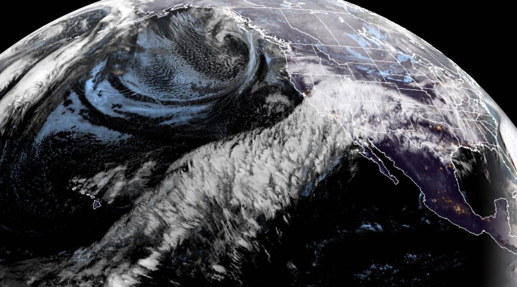
The GOES-17 satellite animation for the past day clearly shows the dramatic plume with its origin in the subtropical Pacific streaming northeastward across California.
An animation of the satellite observed precipitable water illustrates the actual moisture feed.
Precipitable water is the depth of water in a column of the atmosphere, if all the water in that column were precipitated as rain. As a depth, the precipitable water is measured in millimeters or inches.
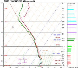
The precipitable water value of 1.68 inches this morning from the NKX(San Diego) sounding is not only its highest ever for February, but also for November through May.
There will be some serious flooding across California due to the combination of very heavy rains and snow melt due to the high snow levels the next few days.