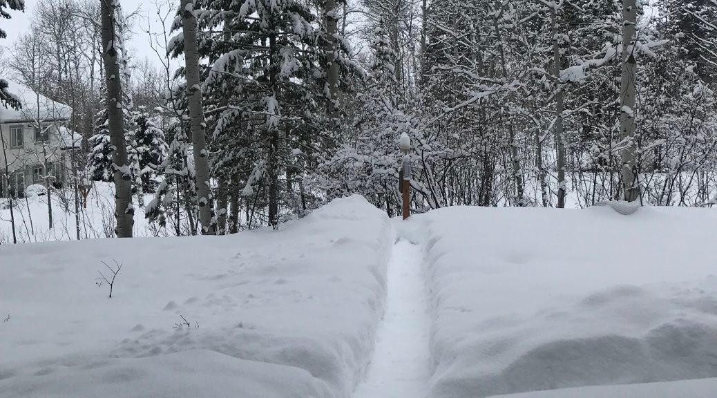
 Post Storm View Near Alpine WY
Public Information Statement
National Weather Service Riverton WY
1255 PM MST Sat Feb 16 2019

...Preliminary Snowfall Totals...

Updated snowfall reports from noon Thursday to 8 am Saturday
morning. This was the second of two storms that impacted the area. A
final statement will be issued this evening after all the reports
are received.

Observations are collected from a variety of sources with varying
types of equipment and exposures. We thank all of our volunteer
weather observers for their dedication. Not all data listed are
considered official.

 Location                              Snowfall

Big Horn County...
 Bald Mountain Snotel...              6 inches.
 Bone Springs Divide Snotel...        5 inches.
 Lovell...                            4 inches.
 Shell Creek Snotel...                4 inches.
 Greybull...                        3.1 inches.
 2 SSW Lovell...                      3 inches.
 9 ENE Greybull...                  2.6 inches.
 Basin...                             2 inches.
 Deaver...                            1 inch.

Fremont County...
 Brooks Lake...                       8 inches.
 South Pass Snotel...                 7 inches.
 Deer Park Snotel...                  7 inches.
 Burroughs Creek Snotel...            5 inches.
 Atlantic City...                   4.7 inches.
 Little Warm Snotel...                4 inches.
 Dubois...                            4 inches.
 St. Lawrence Alt Snotel...           3 inches.
 Hobbs Park Snotel...                 2 inches.
 Castle Creek Snotel...               1 inch.
 Townsend Creek Snotel...             1 inch.
 Shoshoni...                          1 inch.
 9 SSE Lander...                    0.7 inches.
 4 W Riverton...                    0.5 inches.
 Boysen Dam...                      0.5 inches.
 9 SSE Lander...                    0.5 inches.
 Riverton Airport...                0.2 inches.
 Riverton...                        0.2 inches.
 7 WNW Lander...                    0.2 inches.
 6 SW Lander...                     0.2 inches.
 Lander Airport...                  0.1 inches.

Hot Springs County...
 Owl Creek Snotel...                  1 inch.

Johnson County...
 Bear Trap Meadow Snotel...           6 inches.
 Soldier Park Snotel...               2 inches.
 Hansen Sawmill Snotel...             2 inches.
 13 SSE Buffalo...                    1 inch.
 Buffalo...                         0.4 inches.

Lincoln County...
 Commissary Ridge...                 18 inches.
 Blind Bull Summit...                17 inches.
 Willow Creek Snotel...              15 inches.
 Cottonwood Creek Snotel...          11 inches.
 Box Y Ranch...                      10 inches.
 Blind Bull Summit Snotel...          9 inches.
 Indian Creek Snotel...               9 inches.
 Spring Creek Divide Snotel...        9 inches.
 Star Valley Ranch...                 9 inches.
 Salt River Summit Snotel...          8 inches.
 5 SSE Smoot...                       7 inches.
 Kelley Ranger Station Snotel...      7 inches.
 2 SE Thayne...                     6.7 inches.
 3 SE Bedford...                      6 inches.
 1 SW Kemmerer...                     6 inches.
 Hams Fork Snotel...                  5 inches.
 Afton...                           3.4 inches.
 Cokeville...                         3 inches.
 Star Valley Ranch...                 2 inches.
 Fossil Butte...                    0.2 inches.

Natrona County...
 Casper Mountain Snotel...            3 inches.
 1 SW Casper...                     2.8 inches.
 Grave Springs Snotel...              2 inches.
 Reno Hill Snotel...                  2 inches.
 Casper Airport...                  1.7 inches.
 10 WSW Casper...                   1.7 inches.
 5 SSW Casper...                    1.5 inches.
 11 WSW Casper...                   1.2 inches.
 Powder River...                      1 inch.
 Casper...                   0.8 to 0.9 inches.
 1 S Casper...                      0.7 inches.

Park County...
 Pahaska...                           9 inches.
 Evening Star Snotel...               5 inches.
 Blackwater Snotel...                 3 inches.
 Beartooth Lake Snotel...             3 inches.
 Younts Peak Snotel...                3 inches.
 Kirwin Snotel...                     3 inches.
 Wolverine Snotel...                  3 inches.
 Timber Creek Snotel...               2 inches.
 4 ENE Powell...                    1.8 inches.
 26 SW Cody...                      1.5 inches.
 Powell...                          1.5 inches.
 4 SE Cody...                       1.5 inches.
 4 SW Powell...                     1.5 inches.
 Marquette Snotel...                  1 inch.
 2 WSW Cody...                        1 inch.
 Cody...                              1 inch.
 Meeteetse...                         1 inch.
 3 NE Sunshine...                   0.9 inches.
 3 NE Clark...                      0.6 inches.

Sublette County...
 Bondurant...                        11 inches.
 Triple Peak Snotel...               10 inches.
 Gunsite Pass Snotel...               9 inches.
 Loomis Park Snotel...                8 inches.
 East Rim Divide Snotel...            7 inches.
 Kendall Ranger Station Snotel...     7 inches.
 14 NW Pinedale...                  6.3 inches.
 Big Sandy Opening Snotel...          6 inches.
 Pocket Creek Snotel...               6 inches.
 Larsen Creek Snotel...               6 inches.
 Elkhart Park G.S. Snotel...          6 inches.
 Snider Basin Snotel...               5 inches.
 New Fork Lake Snotel...              4 inches.
 Daniel Fish Hatchery...              4 inches.
 Big Piney...                         3 inches.
 Pinedale...                        2.7 inches.
 13 NE Big Piney...                   2 inches.
 Boulder Rearing Station...           1 inch.

Sweetwater County...
 2 NNE Farson...                      2 inches.
 Green River...                     0.7 inches.
 4 NNW Rock Springs...              0.5 inches.
 Wamsutter...                       0.5 inches.
 Rock Springs...                    0.4 inches.

Teton County...
 Jackson Hole - Raymer...            23 inches.
 Jackson Hole - Mid Mountain...      20 inches.
 Jackson Hole - Rendezvous Bowl...   20 inches.
 6 NW Moose...                       15 inches.
 Grand Targhee - Chief Joseph...     13 inches.
 Grand Targhee Snotel...             11 inches.
 Snow King...                        11 inches.
 3 SSW Wilson...                     11 inches.
 Togwotee Mountain Lodge...           8 inches.
 Gros Ventre Summit Snotel...         8 inches.
 Phillips Bench Snotel...             8 inches.
 Grassy Lake Snotel...                7 inches.
 Granite Creek Snotel...              7 inches.
 Togwotee Pass Snotel...              7 inches.
 Jackson Dam...                     6.6 inches.
 5 NW Jackson...                      6 inches.
 Snake River Stn Snotel...            6 inches.
 Jackson Hole - Base...               6 inches.
 Base Camp Snotel...                  6 inches.
 2 NE Teton Village...              5.5 inches.
 Moose...                           4.5 inches.
 1 ENE Teton Village...             4.5 inches.
 Jackson...                         4.1 inches.
 Darwin Ranch...                    1.5 inches.
 1 NNW Alta...                        1 inch.
 12 NE Jackson...                   0.5 inches.

Washakie County...
 Powder River Pass Snotel...          5 inches.
 16 SSE Ten Sleep...                3.5 inches.
 Ten Sleep...                       2.8 inches.
 5 NNW Ten Sleep...                 2.2 inches.
 27 S Ten Sleep...                  2.1 inches.
 Middle Powder Snotel...              1 inch.
 8 SW Worland...                    0.3 inches.

Yellowstone National Park...
 Snake River Ranger Station...       12 inches.
 Lamar Ranger Station...            6.8 inches.
 Thumb Divide Snotel...               6 inches.
 Sylvan Road Snotel...                6 inches.
 Sylvan Lake Snotel...                6 inches.
 Yellowstone East Entrance...         6 inches.
 Parker Peak Snotel...                5 inches.
 Lewis Lake Divide Snotel...          5 inches.
 Two Ocean Plateau Snotel...          4 inches.
 Canyon Snotel...                     4 inches.
 Northeast Entrance Ranger Station... 4 inches.
 Mammoth...                         3.5 inches.
 Tower Falls Ranger Station...        3 inches.