National Weather Service Riverton WY
1012 AM MST Wed Feb 27 2019
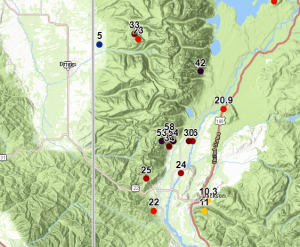
...Preliminary Snowfall Totals Through 9 AM Wednesday...
The following snowfall reports are preliminary winter storm totals
for western and northern Wyoming from 6 PM Saturday through 9 AM
Wednesday. The highest storm totals have been seen across the Teton
Range, where amounts have reached 3 to nearly 5 feet. The snow will
continue over far western Wyoming Wednesday.
Observations are collected from a variety of sources with varying
types of equipment and exposures. We thank all of our volunteer
weather observers for their dedication. Not all data listed are
considered official.
Note: SnoTELS (Snow Telemetry) are remote sensing sites in high
mountain watersheds. Snowfall data from SNOTELS are estimated based
on snow water equivalent.
Location Snowfall
Big Horn County...
1 W Lovell... 3 inches.
Bald Mountain Snotel... 3 inches.
Bone Springs DivideSnotel... 3 inches.
Shell CreekSnotel... 2 inches.
Deaver... 2 inches.
2 SSW Lovell... 1.5 inches.
Greybull... 1.4 inches.
9 ENE Greybull... 1.1 inches.
Basin... 1 inch.
Fremont County...
Brooks Lake... 27 inches.
Burroughs CreekSnotel... 22 inches.
Castle CreekSnotel... 5 inches.
Little Warm Snotel... 5 inches.
South Pass Snotel... 5 inches.
Deer Park Snotel... 4 inches.
Cold Springs Snotel... 2 inches.
Townsend CreekSnotel... 2 inches.
Atlantic City... 1 inch.
Hobbs Park Snotel... 1 inch.
St. Lawrence Alt Snotel... 1 inch.
Hot Springs County...
Owl CreekSnotel... 4 inches.
6 N Thermopolis... 1.1 inches.
Thermopolis... 0.5 inches.
Johnson County...
Soldier Park Snotel... 3 inches.
Little Goose Snotel... 3 inches.
Hansen Sawmill Snotel... 2 inches.
17 E Kaycee... 1 inch.
Cloud Peak ReservoirSnotel... 1 inch.
Kaycee... 0.5 inches.
4 SSW Buffalo... 0.4 inches.
13 SSE Buffalo... 0.3 inches.
Buffalo... 0.2 inches.