Warmer Spring Weather Ahead
Since about the 1st of February it has been an unusually prolonged period of cloudy and snowy weather across Western Wyoming including Star Valley. While Spring is going into its 4th week, the long anticipated warm up which will begin the mountain snow pack runoff has yet to occur. One more wet, cool weather system early this coming week and then it appears a pattern change will provide the long anticipated warm-up.
Reviewing the weather since the first of February, the graphs of both temperature and precipitation from Afton provide the picture:
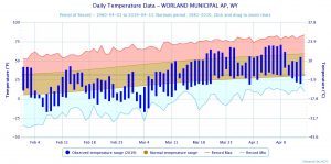
There have been some brief periods since Feb 1st when temperatures were a little above normal but mostly it was a cool, cloudy period.
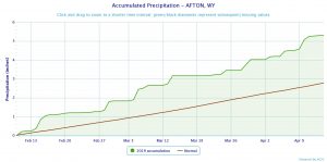
There were a couple dry periods in February and late March , however much of the period was wet and snowy. Precipitation for the period was well above normal.
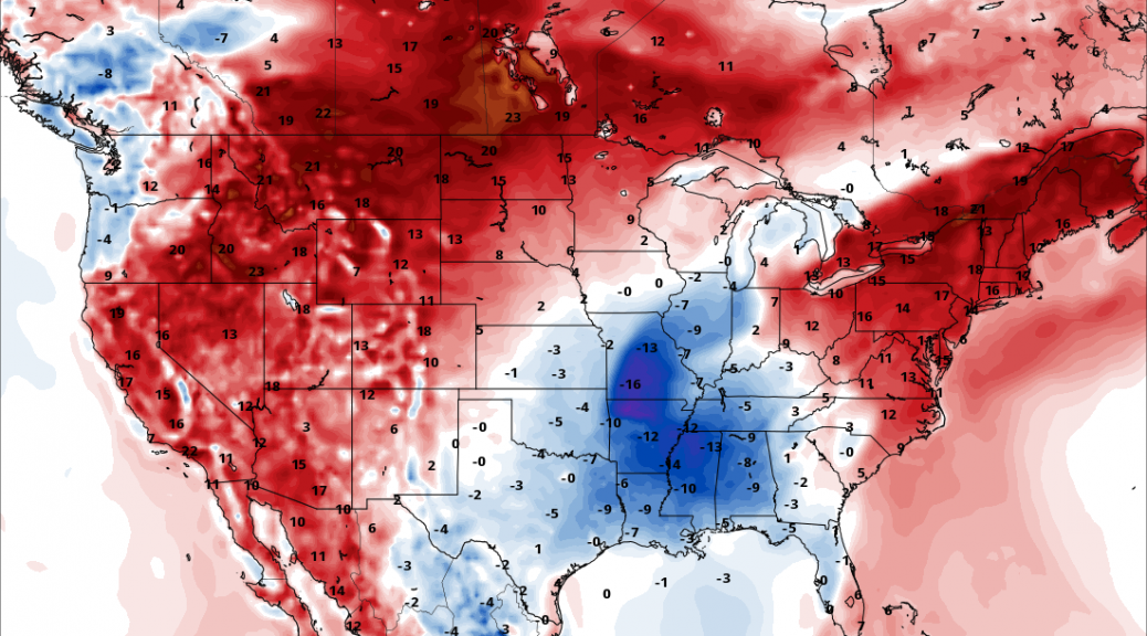
Looking forward there is a change in the model world for later this week. The following 500 mb charts show the building of a strong upper high pressure from the Eastern Pacific to the Rocky Mountain states by the end of the week.
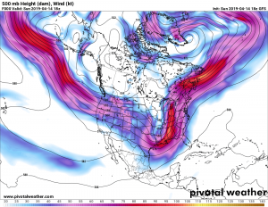
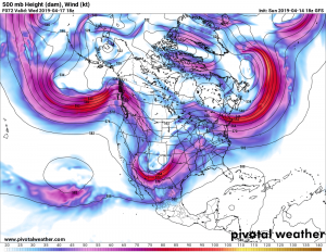
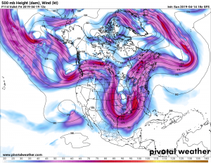
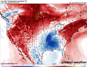
Using these model forecasts the surface temperatures will respond as the following three surface charts show
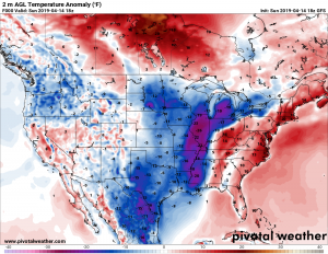
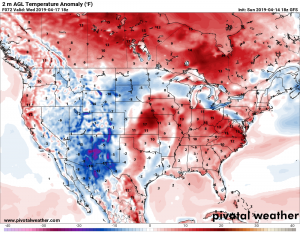
And then when the high pressure builds into the Rockies on Friday a big warm-up occurs.
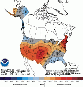
Looking further ahead from April 20-24 it is hopeful that milder temperatures will continue into the first of the next week.