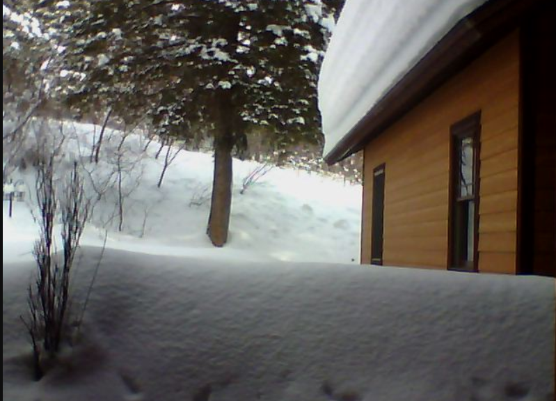
Snow Fall Reports for Latest Storm and Winter so Far in Star Valley
It has been a snowy 2020 so far across Star Valley. Including the latest storm here are the measured snowfalls for some Star Valley Communities.
Since New Years Day Since Oct 1 2019
Star Valley Ranch 130 inches 191 inches
Smoot 6 SSE 116 inches 200 inches
Bedford 3 SE 108 inches 163 inches
Thayne 104 inches 156 inches
Afton 64 inches 108 inches
Bedford 3SE record for period Oct 1-Feb 17 was 208 inches in the winter of 1977-78
National Weather Service Riverton WY
1215 AM MDT Mon Feb 17 2020

Another winter storm system moved across western and central Wyoming
over the Washington`s Birthday holiday weekend. The following are
final snowfall totals for Saturday morning through Monday morning.
We thank our observers and spotters for their dedication to provide
their snow reports.

Note: SNOTELS (Snow Telemetry) are remote sensing sites in high
mountain watersheds. Snowfall data from SNOTELS are estimated based
on snow water equivalent.

Location                              Snowfall

Big Horn County...
 Shell Creek Snotel...                4 inches.
 Bald Mountain Snotel...              3 inches.
 Bone Springs Divide Snotel...        3 inches.
 2 SSW Lovell...                      1 inch.
 Deaver...                          0.5 inches.
 9 ENE Greybull...                  0.4 inches.

Fremont County...
 Brooks Lake...                      16 inches.
 Burroughs Creek Snotel...            8 inches.
 Little Warm Snotel...                5 inches.
 Castle Creek Snotel...               4 inches.
 Deer Park Snotel...                  4 inches.
 South Pass Snotel...                 4 inches.
 Boysen Dam...                        2 inches.
 Dubois...                            2 inches.
 Riverton...                        1.3 inches.
 Riverton Airport...                1.1 inches.
 Riverton 1 W...                      1 inch.

Hot Springs County...
 6 N Thermopolis...                 2.5 inches.
 9 NE Thermopolis...                2.1 inches.

Johnson County...
 Cloud Peak Reservoir Snotel...       4 inches.
 Bear Trap Meadow Snotel...           3 inches.
 Little Goose Snotel...               3 inches.
 Soldier Park Snotel...               3 inches.
 Hansen Sawmill Snotel...             2 inches.
 13 SSE Buffalo...                   1.5 inches.

Lincoln County...
 Blind Bull Summit...                15 inches.
 Star Valley Ranch...                15 inches.
 Alpine...                           15 inches.
 Box Y Ranch...                      13 inches.
 Commissary Ridge...                 12 inches.
 2 SE Thayne...                      11 inches.
 Blind Bull Summit Snotel...         11 inches.
 Spring Creek Divide Snotel...       11 inches.
 Alpine 1 N...                     10.1 inches.
 Cottonwood Creek Snotel...          10 inches.
 Willow Creek Snotel...               9 inches.
 3 SE Bedford...                      9 inches.
 5 SSE Smoot...                       7 inches.
 Salt River Summit Snotel...          7 inches.
 Kelley Ranger Station Snotel...      6 inches.
 Indian Creek Snotel...               4 inches.
 Hams Fork Snotel...                  4 inches.
 Afton...                           3.4 inches.

Natrona County...
 Reno Hill Snotel...                  5 inches.
 Grave Springs Snotel...              2 inches.
 Casper Mountain Snotel...            2 inches.
 Casper...                          1.5 inches.
 Casper Airport...                  1.4 inches.
 Powder River...                      1 inch.

Park County...
 Evening Star Snotel...              13 inches.
 Pahaska...                           8 inches.
 Wolverine Snotel...                  6 inches.
 Blackwater Snotel...                 6 inches.
 Kirwin Snotel...                     5 inches.
 Beartooth Lake Snotel...             5 inches.
 Younts Peak Snotel...                4 inches.
 Cody...                              1 inch.
 2 WSW Cody...                        1 inch.
 3 NE Sunshine...                   0.8 inches.
 3 NE Clark...                      0.5 inches.
 4 ENE Powell...                    0.3 inches.
 4 SW Powell...                     0.1 inches.

Sublette County...
 Triple Peak Snotel...               14 inches.
 Kendall Ranger Station Snotel...    12 inches.
 Snider Basin Snotel...               8 inches.
 Merna...                             7 inches.
 Loomis Park Snotel...                7 inches.
 Elkhart Park G.S. Snotel...          5 inches.
 East Rim Divide Snotel...            5 inches.
 Big Sandy Opening Snotel...          4 inches.
 Gunsite Pass Snotel...               4 inches.
 Larsen Creek Snotel...               4 inches.
 1 E Pinedale...                    3.5 inches.
 14 NW Pinedale...                  3.3 inches.
 New Fork Lake Snotel...              3 inches.
 Daniel Fish Hatchery...              1 inch.

Sweetwater County...
 Green River...                     1.2 inches.
 Green River 1 E...                 0.8 inches.

Teton County...
 Jackson Hole - Raymer...          28.5 inches.
 6 NW Moose...                       27 inches.
 Jackson Hole - Rendezvous Bowl...   23 inches.
 Jackson Hole - Mid Mountain...      22 inches.
 Grand Targhee - Chief Joseph...     18 inches.
 Grassy Lake Snotel...               14 inches.
 Togwotee Pass Snotel...             14 inches.
 Grand Targhee Snotel...             12 inches.
 Snake River Stn Snotel...           12 inches.
 Togwotee Mountain Lodge...          12 inches.
 Granite Creek Snotel...             10 inches.
 Jackson Hole - Base...             8.5 inches.
 1 ENE Teton Village...               8 inches.
 Base Camp Snotel...                  6 inches.
 5 NW Jackson...                      5 inches.
 Snow King...                         5 inches.
 3 SSW Wilson...                      5 inches.
 Darwin Ranch...                    4.3 inches.
 Gros Ventre Summit Snotel...         4 inches.
 Phillips Bench Snotel...             4 inches.
 2 NE Teton Village...                3 inches.
 12 NE Jackson...                     3 inches.
 1 NNW Alta...                        3 inches.
 Jackson...                         1.5 inches.

Washakie County...
 Middle Powder Snotel...              5 inches.
 Powder River Pass Snotel...          3 inches.
 27 S Ten Sleep...                  1.7 inches.
 Winchester...                        1 inch.
 16 SSE Ten Sleep...                  1 inch.
 Ten Sleep...                       0.8 inches.
 4 N Ten Sleep...                   0.3 inches.

Yellowstone National Park...
 Lewis Lake Divide Snotel...         13 inches.
 Yellowstone East Entrance...         9 inches.
 Two Ocean Plateau Snotel...          6 inches.
 Sylvan Lake Snotel...                4 inches.
 Sylvan Road Snotel...                3 inches.
 Lamar Ranger Station...            2.5 inches.
 Thumb Divide Snotel...               2 inches.
 Parker Peak Snotel...                2 inches.
 Canyon Snotel...                     2 inches.

Observations are collected from a variety of sources with varying
equipment and exposures. We thank all volunteer weather observers
for their dedication. Not all data listed are considered official.