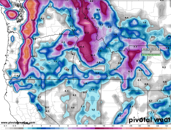
Snows Return to Western Wyoming
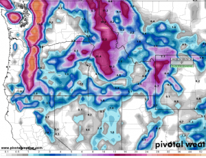
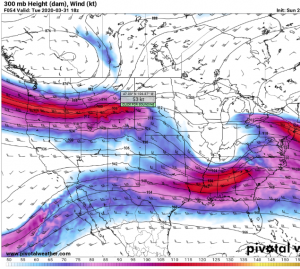
Special Weather Statement
National Weather Service Riverton WY
250 PM MDT Sun Mar 29 2020


Yellowstone National Park-Absaroka Mountains-
Teton and Gros Ventre Mountains-Jackson Hole-
Wind River Mountains West-Wind River Mountains East-Star Valley-
Salt River and Wyoming Ranges-Upper Green River Basin Foothills-
Upper Green River Basin-
Including the cities of Lake, Mammoth, Old Faithful, Jackson,
Afton, Alpine, Star Valley Ranch, Thayne, Pinedale, La Barge,
Big Piney, and Farson

250 PM MDT Sun Mar 29 2020

...Significant snowfall expected for far western Wyoming Monday
night and Tuesday...

A potent winter storm will be organizing in the Pacific Northwest
early this week and will push a strong cold front across Western
Wyoming Monday night and Tuesday. This front will deliver
significant snowfall to the area during this time frame.

* WHAT...6 to 12 inches of snow in the mountains and 3 to 6 inches
  in the valleys. One to three inches are expected in the northern
  portion of the Upper Green River Basin.

* WHERE...Far western Wyoming.

* WHEN...Monday night and Tuesday.

* ADDITIONAL DETAILS...The snow will start as a mixture of rain
  and snow in the far west valleys Monday evening before quickly
  turning to all snow. Increasing winds will create some blowing
  and drifting snow, especially at the higher elevations during
  the day Tuesday.

A strong polar jet will sweep across Wyoming during the first part of the upcoming week and bring
significant precipitation to Western Wyoming.
Of interest to most would be the amount of snowfall this winter and how it compares to previous winters. The following are the data from the weather station at Star Valley Ranch for the past 4 winters.
The precipitation data is from Oct 1st to March 29 each year including the observed snow depth on March 29th in the last column
Year Snowfall Precipitation
2019/20 215.9 14.93 16
2018/19 190.2 15.54 28
2017/18 164.5 14.97 17
2016/17 219.1 24.20 5