URGENT - WINTER WEATHER MESSAGE
National Weather Service Riverton WY
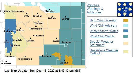
118 PM MST Sun Dec 18 2022
 WYZ023-024-191300-
/O.NEW.KRIW.WS.A.0012.221220T0600Z-221222T0600Z/
Star Valley-Salt River and Wyoming Ranges-
Including the cities of Afton, Alpine, Star Valley Ranch,
and Thayne
118 PM MST Sun Dec 18 2022
...WINTER STORM WATCH IN EFFECT FROM MONDAY EVENING THROUGH
WEDNESDAY EVENING...
* WHAT...Heavy snow and blowing snow possible. Total snow
accumulations of 4 to 8 inches in the lower elevations. In the
mountains, 12 to 18 inches expected. Winds could gust as high
as 55 mph in the mountains.
* WHERE...Star Valley and Salt River and Wyoming Ranges.
* WHEN...From Monday evening through Wednesday evening. The
heaviest snow is expected late Tuesday night through Wednesday
evening.
* IMPACTS...Travel could be very difficult especially over
mountain passes which includes Salt River Pass. Snow and blowing
snow will severely limit visibility at times especially in the
mountains.
* ADDITIONAL DETAILS...Backcountry enthusiasts including
snowmobilers can easily become disoriented and lost. Frostbite
and hypothermia can set in quickly. Please monitor the Bridger-
Teton Avalanche Center at JHAVALANCHE.ORG, if your plans include
travel into the backcountry.
PRECAUTIONARY/PREPAREDNESS ACTIONS...
Monitor the latest forecasts for updates on this situation.
WYZ023-024-191300-
/O.NEW.KRIW.WS.A.0012.221220T0600Z-221222T0600Z/
Star Valley-Salt River and Wyoming Ranges-
Including the cities of Afton, Alpine, Star Valley Ranch,
and Thayne
118 PM MST Sun Dec 18 2022
...WINTER STORM WATCH IN EFFECT FROM MONDAY EVENING THROUGH
WEDNESDAY EVENING...
* WHAT...Heavy snow and blowing snow possible. Total snow
accumulations of 4 to 8 inches in the lower elevations. In the
mountains, 12 to 18 inches expected. Winds could gust as high
as 55 mph in the mountains.
* WHERE...Star Valley and Salt River and Wyoming Ranges.
* WHEN...From Monday evening through Wednesday evening. The
heaviest snow is expected late Tuesday night through Wednesday
evening.
* IMPACTS...Travel could be very difficult especially over
mountain passes which includes Salt River Pass. Snow and blowing
snow will severely limit visibility at times especially in the
mountains.
* ADDITIONAL DETAILS...Backcountry enthusiasts including
snowmobilers can easily become disoriented and lost. Frostbite
and hypothermia can set in quickly. Please monitor the Bridger-
Teton Avalanche Center at JHAVALANCHE.ORG, if your plans include
travel into the backcountry.
PRECAUTIONARY/PREPAREDNESS ACTIONS...
Monitor the latest forecasts for updates on this situation.