Where Has All the Smoke Gone?
|
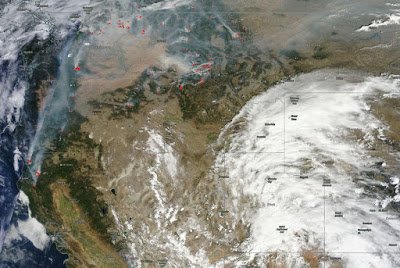
This satellite photo was taken Wednesday afternoon August 26 2015
|
| Today’s Satellite (MODIS) image from https://worldview.earthdata.nasa.gov/ showing wildfires across the northwest U.S. (red areas) and smoke being carried up and over a ridge of high pressure over the Rocky Mountain region, west and north of Wyoming. |
