 |
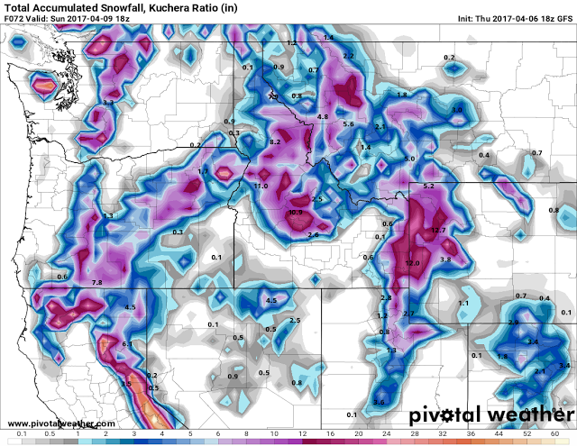
| Model Snow Amounts Forecast ending midday Sunday April 9 2017
|
 |
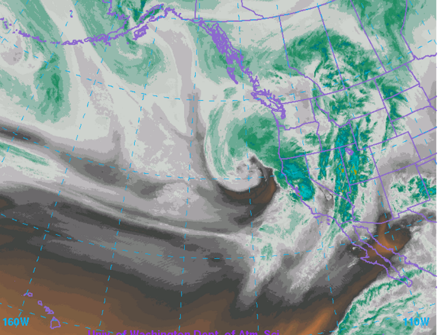
| Water Vapor Imagery Thursday Evening April 6 2017
The intense storm system noted in the Thursday evening WV Satellite imagery off the
Oregon coast will bring a return to winter conditions in the higher elevations of Wyoming
over the weekend
|
National Weather Service Riverton WY
127 PM MDT Thu Apr 6 2017

...Heavy wet snow for the western mountains Friday night through
Saturday night...

.A strong wet Pacific low pressure trough will bring periods
of heavy wet snow to the Teton, Gros Ventre, Wyoming, Salt River
and Wind river mountains Friday night through Saturday night.
Rain or a rain snow mix is expected below 7500 feet in the Star
valley and Jackson Hole with local accumulations.


Salt River and Wyoming Ranges-
127 PM MDT Thu Apr 6 2017

...WINTER STORM WATCH IN EFFECT FROM FRIDAY EVENING THROUGH LATE
SATURDAY NIGHT...

The National Weather Service in Riverton has issued a Winter
Storm Watch, which is in effect from Friday evening through late
Saturday night.

* TIMING...Snow showers will move into the western mountains
  Friday Afternoon. Showers will become widespread with periods of
  heavy wet snow Friday evening with periods of heavy snow
  continuing Saturday through Saturday night.

* Snow accumulation...8 to 16 inches.

* MAIN IMPACT...Travel over Salt river pass will become difficult
  with deep wet snow accumulating on road surfaces and visibility
  being reduced below an eighth of a mile at times.

* OTHER IMPACTS...Heavy wet snow will make outdoor activities
  difficult and increase the threat of hypothermia for those
  without proper winter clothing.

PRECAUTIONARY/PREPAREDNESS ACTIONS...

A winter storm watch means there is a potential for significant
snow and/or blowing snow that may impact travel. Continue to
monitor the latest forecasts.


