 |
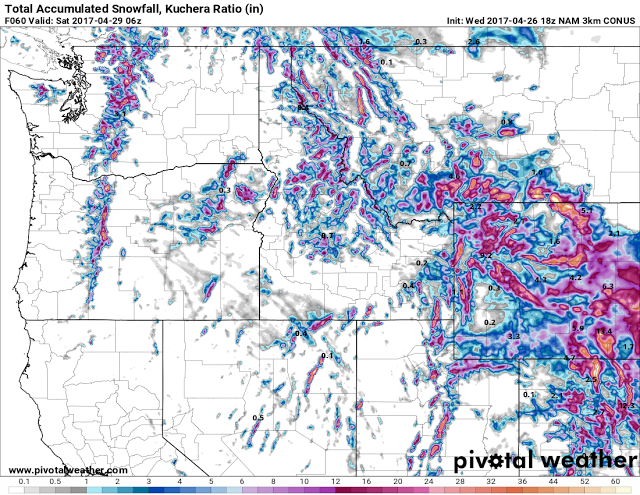
| Model Total Snow Forecast Through midnight Friday |
URGENT - WINTER WEATHER MESSAGE
National Weather Service Riverton WY
257 PM MDT Wed Apr 26 2017

...MORE SNOW RETURNING TO WESTERN AND CENTRAL WYOMING THROUGH
FRIDAY NIGHT...

.A low pressure storm system moving across the Pacific northwest
will spread increasing snow into the west tonight and Thursday.
Through Thursday the snow will spread east of the Continental
Divide across the north. The storm system will then strengthen
and close off over south central to southeast Wyoming Thursday
night with potential heavy convective snow developing over the
Big Horn mountains, Johnson, Fremont and Natrona counties.

The mountains may see 10 to 20 inches of snow with 5 to 10 inches
in the lower elevations with local 12 to 15 inch amounts possible
in the foothills areas around Buffalo, Casper and Lander. The
storm system will dig south across northern Colorado and
eventually into northern New Mexico by Saturday when the storm
will be too far south for major impacts in Wyoming.


Jackson Hole-Star Valley-
Including the cities of Jackson, Afton, Alpine,
Star Valley Ranch, and Thayne
257 PM MDT Wed Apr 26 2017

...WINTER WEATHER ADVISORY REMAINS IN EFFECT FROM 6 PM THIS
EVENING TO NOON MDT THURSDAY...

* TIMING...A mix of rain and snow will change to snow tonight
  and continue into Thursday.

* TOTAL SNOW...3 to 8 inches.

* MAIN IMPACT...Highways will become slick, slushy or snow
  covered.

