Two Weather Systems to Affect Star Valley this Work Week
Looking ahead the work week will start out with another fine weather day like was experienced Sunday with Monday’s temperatures a few degrees warmer. Then a couple of weather systems move from the Pacific across Wyoming and surrounding areas, the first Tuesday followed be a stronger and colder one by later Thursday into Friday.
The animated infrared satellite loop from Sunday afternoon shows the first system approaching the coast of the Pacific Northwest. It will weaken as it moves inland Monday while at the same time the upstream trough over the Gulf of Alaska deepens southeastward.
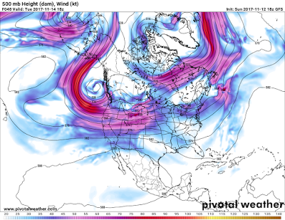
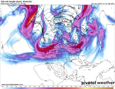
This scenario can be seen in a series of 500mb charts.
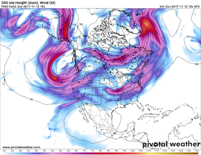 |
| 500 mb analysis noon Sunday Nov. 12 2017
|
500mb Forecast noon Tuesday November 14 2017
500 mb Forecast noon Thursday November 16 2017
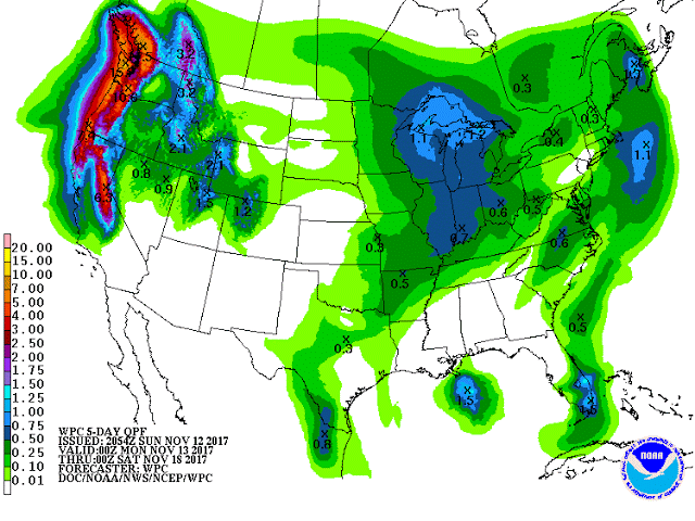
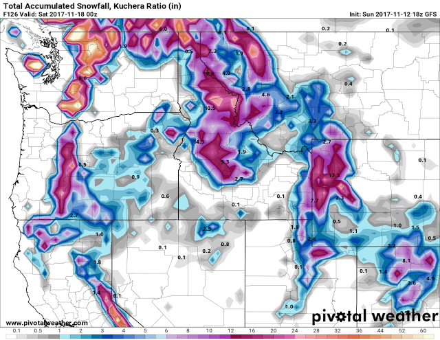
Precipitation for the coming week will be most significant with system number two which will affect Western Wyoming/Star Valley Thursday into Friday. The forecast precipitation for the week ending later Friday indicates up to 2 inches in the Western Wyoming mountains in the form of snow. Far less than the up to 15 inches expected in Western Washington.
Total Model Snowfall for the 5 day period ending Friday Evening Nov. 17 2017
