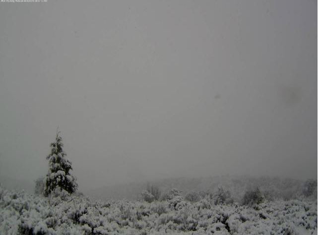
Rain and Snow Totals Western Wyoming as of Monday Afternoon

…Here are a few early Snowfall amounts around Western Wyoming
Mountains since late last night…
Location Snowfall
Fremont County…
Deer Park Snotel… 12 inches.
South Pass Snotel… 9 inches.
Townsend Creek Snotel… 5 inches.
Cold Springs Snotel… 2 inches.
Lincoln County…
Kelley Ranger Station Snotel… 7 inches.
Salt River Summit Snotel… 4 inches.
Willow Creek Snotel… 3 inches.
Cottonwood Creek Snotel… 3 inches.
Blind Bull Summit Snotel… 2 inches.
Spring Creek Divide Snotel… 2 inches.
Indian Creek Snotel… 2 inches.
Star Valley Ranch…….2 inches
Sublette County…
Triple Peak Snotel… 4 inches.
Big Sandy Opening Snotel… 3 inches.
Teton County…
Grand Targhee Snotel… 3 inches.
Togwotee Pass Snotel… 2 inches.
Phillips Bench Snotel… 2 inches.
National Weather Service Riverton WY
623 PM MDT Mon Apr 30 2018

...Here are some Rainfall Reports for the storm through 600 PM
MDT Monday evening...

Location                     Amount     Elevation (ft.)

...Yellowstone National Park...
4 W South Entrance YNP       0.58 in    7040
South Entrance YNP           0.29 in    6900
Extreme Sw Yellowstone       0.16 in    6400
9 E Tower Junction           0.09 in    7266
Lake Yellowstone             0.08 in    7835
Lake Village                 0.07 in    7875
Mammoth                      0.06 in    6300
15 WSW Mammoth               0.05 in    7900
1 SW Canyon                  0.03 in    7900
Gardner River Nr Mammoth, Ye 0.01 in    5624
Tower Falls                  0.01 in    6266

...Wind River Mountains West...
3 NNE South Pass City        0.60 in    8540
8 W South Pass City          0.36 in    8120
19 WSW Dubois                0.20 in    8833
7 NE Pinedale                0.10 in    8530
Boulder Lake                 0.01 in    7350

...Wind River Mountains East...
9 SW Lander                  0.92 in    7085
10 W Fort Washakie           0.14 in    9235
10 W Dubois                  0.08 in    8432

...Wind River Basin...
Riverton Weather Office      1.03 in    5576
3 NNW Hudson                 1.01 in    5555
Riverton Airport             0.99 in    5443
Boysen Reservoir             0.91 in    4710
Shoshoni                     0.77 in    4837
10 SE Crowheart              0.60 in    5654
Riverton - CWC               0.52 in    5372
Fort Washakie                0.46 in    5565
N. Fork Little Wind River    0.36 in    6120

...Upper Wind River Basin...
Crowheart                    0.68 in    6099
11 W Crowheart               0.41 in    6520
6 NW Dubois                  0.13 in    7189

...Upper Green River Basin...
9 E Big Piney                0.08 in    6803
5 SSE La Barge               0.05 in    6530

...Upper Green River Basin Foothills...
Bondurant                    0.63 in    6650
2 NW Bondurant               0.27 in    6726
10 NNW Daniel                0.17 in    7470
Pinedale                     0.13 in    7310

...Teton and Gros Ventre Mountains...
Alta                         0.52 in    6430
17 N Alta                    0.24 in    6830

...Star Valley...
Afton                        0.65 in    6267
1 S Bedford                  0.59 in    6279
3 NW Etna                    0.56 in    5692
1 NW Afton                   0.54 in    6211
Thayne                       0.48 in    5928
Etna                         0.47 in    5823
4 NE Thayne                  0.39 in    6217
Bedford - Coop               0.31 in    6425
3 NW Etna                    0.31 in    5676
Afton - Coop                 0.24 in    6245

...Southwest Big Horn Basin...
Kirby                        0.80 in    4350
Thermopolis                  0.56 in    4313
Thermopolis                  0.32 in    4426
Thermopolis 9 NE             0.02 in    4280

...Southeast Johnson County...
Kaycee                       0.01 in    4681
2 NW Mayoworth               0.01 in    5404
Linch                        0.01 in    4934

...Southeast Big Horn Basin...
Worland                      0.64 in    4042
Worland Airport              0.48 in    4226
10 SSE Worland               0.48 in    4520
1 NNE Worland                0.43 in    4065
1 SE Ten Sleep               0.34 in    4419
Ten Sleep                    0.25 in    4470

...South Lincoln County...
Cokeville                    0.35 in    6191
Fossil Butte                 0.30 in    6780
Kemmerer                     0.10 in    6980

...Salt River and Wyoming Ranges...
Smiths Fork Near Border      0.34 in    6650
15 NE Cokeville              0.21 in    8470
13 E Cokeville               0.18 in    7460
21 W Big Piney               0.05 in    8200

...Rock Springs and Green River...
3 NW Rock Springs            0.24 in    6458
Mckinnon                     0.21 in    7086
Green River                  0.20 in    6091
Rock Springs                 0.18 in    6270
Green River                  0.14 in    6060
12 W Green River             0.07 in    6130

...Owl Creek and Bridger Mountains...
S. Fork Owl Creek Below Anch 0.57 in    6120
10 S Meeteetse               0.33 in    7127

...Northeast Johnson County...
8 S Story                    0.16 in    5279
Buffalo Airport              0.01 in    4925

...North Big Horn Basin...
Deaver - Coop                0.11 in    4105
Basin                        0.09 in    3821
Lovell                       0.09 in    3830
Basin                        0.08 in    3897
11 ESE Lovell                0.08 in    3660
Greybull Airport             0.08 in    3934
Powell                       0.06 in    4370
Greybull                     0.04 in    3860
2 N Frannie                  0.02 in    4275

...Natrona County Lower Elevations...
Natrona County Airport       0.40 in    5348
Casper - N Platte River      0.12 in    5100
Mills                        0.10 in    5150
Midwest                      0.06 in    4865
3 WSW Mills                  0.04 in    5197
8 SE Evansville              0.03 in    5592

...Lander Foothills...
Middle Fork Popo Agie River  1.24 in    6555
Lander Airport               1.07 in    5587
11 SSE Lander                1.09 in    5773
N Fork Popo Agie River       0.64 in    5760
7 NW Lander                  0.55 in    5797
Lander                       0.16 in    5320

...Jackson Hole...
Snake River At Jackson Lake  0.49 in    6779
3 SSW Jackson                0.38 in    6158
Jackson                      0.33 in    6240
Jackson                      0.31 in    6247
2 NE Wilson                  0.27 in    6184
Moose                        0.27 in    6466
7 E Moran Jct                0.24 in    7251
Moran Junction               0.19 in    6749
4 N Moose                    0.13 in    6730
Kelly                        0.08 in    6653

...Green Mountains and Rattlesnake Range...
Independence Rock            0.08 in    5920
16 S Hiland                  0.07 in    6380
Pathfinder Reservoir         0.04 in    5858
7 SW Muddy Gap               0.03 in    7380
Jeffrey City                 0.03 in    6374

...Flaming Gorge...
3 NE Manila Ut               0.01 in    6060

...East Sweetwater County...
15 SE Rock Springs           0.09 in    7550
Rock Springs Airport         0.02 in    6759
4 NE Bitter Creek            0.01 in    6720

...Cody Foothills...
2 W Pitchfork                1.01 in    6883
3 NE Clark                   0.30 in    4090
Meeteetse                    0.26 in    5797
20 SW Cody                   0.24 in    5843
2 WSW Cody                   0.20 in    5167
6 SW Meeteetse               0.16 in    6238
Cody - Coop                  0.13 in    5085
Buffalo Bill Reservoir       0.03 in    5357
1 W Clark                    0.03 in    4270

...Casper Mountain...
13 S Casper                  0.07 in    6830
8 S Casper                   0.05 in    7740

...Bighorn Mountains West...
30 E Greybull                0.35 in    8898
15 SSW Big Trails            0.27 in    6554
12 ENE Ten Sleep             0.26 in    8202
5 ENE Hyattville             0.21 in    5670

...Bighorn Mountains Southeast...
14 W Buffalo                 0.29 in    8400
18 NW Buffalo                0.29 in    8604
20 NW Mayoworth              0.16 in    8180
7 SW Barnum                  0.12 in    6440
16 SE Big Trails             0.09 in    7220
18 WNW Buffalo               0.07 in    8580
7 WSW Buffalo                0.06 in    5745

...Absaroka Mountains...
9 SE Pitchfork               0.62 in    6804
10 N Dubois                  0.23 in    8085
6 E Sunlight Basin           0.12 in    6228
Crandall                     0.06 in    6640
14 ENE Dubois                0.06 in    7365
3 E Pahaska                  0.03 in    7500

Observations are collected from a variety of sources with varying
equipment and exposures. We thank all volunteer weather observers
for their dedication. Not all data listed are considered official.