A series of cold fronts brought widespread precipitation amounts of 1 to 2 inches across the west from Monday through Thursday night. Portions of the Star Valley and Yellowstone National Park received from 2 to over 3 inches of precipitation; the highest total of 3.07 inches was reported 5 miles north of Thayne in the Star Valley. A strong cold frontal passage also resulted in some high winds across the area on Wednesday with an automated station 15 miles southeast of Rock Springs reporting a gust to 81 mph Wednesday afternoon.
***** Final Update *****
 |
 |
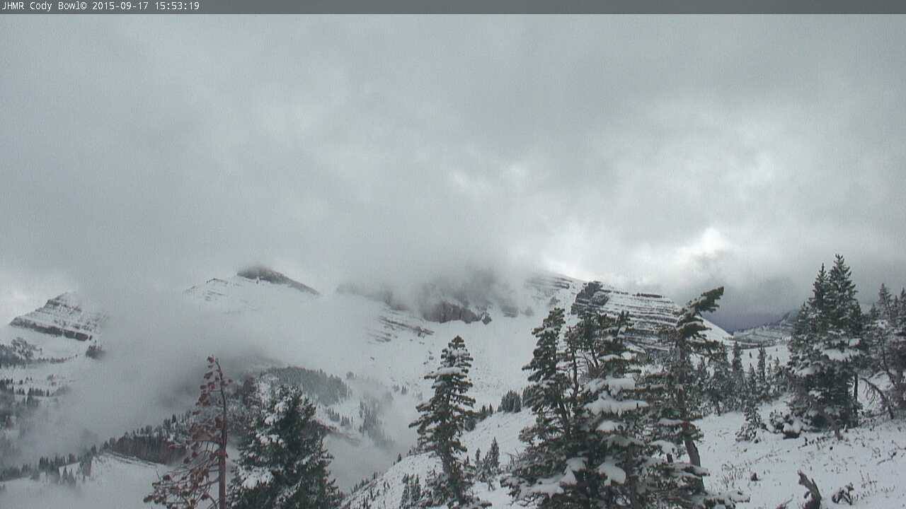
| Clouds parting at Jackson Hole Mountain Resort’s Cody Bowl (elev. 10,450 ft.) Friday afternoon to reveal a winter wonderland in the last few days of summer. Click to Enlarge |
A 64 mph was recorded in Sinks Canyon on Wednesday morning. Only 0.01 inches of rainfall fell Thursday afternoon in Sinks Canyon, and then the double rainbow! Click to Enlarge |
Click on map to enlarge
 |
|
Precipitation Totals from Monday, September 14th through 7 AM Friday, September 18th
| County |
Station Name |
Rainfall |
| Big Horn |
Mill Creek |
0.57 |
| Big Horn |
Shell |
0.25 |
| Big Horn |
9 NNW Shell |
0.15 |
| Big Horn |
Lovell |
0.12 |
| Big Horn |
2 SSW Lovell |
0.12 |
| Big Horn |
Deaver |
0.10 |
| Big Horn |
Hyatt High |
0.08 |
| Big Horn |
Greybull |
0.03 |
| Big Horn |
Greybull ASOS |
0.01 |
| Fremont |
Raspberry |
1.23 |
| Fremont |
10 WNW Dubois |
0.52 |
| Fremont |
Elkhorn |
0.27 |
| Fremont |
Dubois |
0.24 |
| Fremont |
Anderson Ridge |
0.14 |
| Fremont |
Wind River |
0.11 |
| Fremont |
Camp Creek |
0.09 |
| Fremont |
Atlantic City |
0.08 |
| Fremont |
Riverton 0.5 NW |
0.03 |
| Fremont |
9 SSE Lander |
0.03 |
| Fremont |
6 SW Lander |
0.03 |
| Fremont |
Burris |
0.03 |
| Fremont |
Jeffrey City |
0.02 |
| Fremont |
Riverton |
0.01 |
| Fremont |
Riverton ASOS |
0.01 |
| Hot Springs |
9 NE Thermopolis |
0.06 |
| Johnson |
School House |
0.10 |
| Johnson |
Buffalo ASOS |
0.10 |
| Johnson |
12 SSE Buffalo |
0.06 |
| Johnson |
17 NNW Kaycee |
0.01 |
| Lincoln |
5 NNE Thayne |
3.07 |
| Lincoln |
3 NW Etna |
2.92 |
| Lincoln |
Star Valley Ranch |
2.81 |
| Lincoln |
2 SE Thayne |
2.75 |
| Lincoln |
1 S Bedford |
2.28 |
| Lincoln |
5 SSE Smoot |
1.98 |
| Lincoln |
Afton |
1.92 |
| Lincoln |
1 SW Afton |
1.86 |
| Lincoln |
Kelly |
1.67 |
| Lincoln |
Etna |
1.42 |
| Lincoln |
Fossil Butte |
1.10 |
| Lincoln |
3 WNW Kemmerer |
0.95 |
| Lincoln |
3 SE Bedford |
0.94 |
| Lincoln |
5 SSE La Barge |
0.39 |
| MONTANA |
Soda Butte |
1.12 |
| Natrona |
11 ESE Casper |
0.05 |
| Natrona |
5 SSW Casper |
0.03 |
| Natrona |
7 SSW Casper |
0.02 |
| Natrona |
12 NE Lysite |
0.02 |
| Natrona |
Casper Mountain |
0.01 |
| Natrona |
10 WSW Casper |
0.01 |
| Park |
Quadrant |
2.92 |
| Park |
Pahaska |
1.12 |
| Park |
Cabin Creek |
0.90 |
| Park |
Eagle |
0.57 |
| Park |
Crandall |
0.30 |
| Park |
26 SW Cody |
0.27 |
| Park |
2 WSW Cody |
0.12 |
| Park |
Rattlesnake Mountain |
0.12 |
| Park |
Cody |
0.09 |
| Park |
3 NE Sunshine |
0.07 |
| Park |
4 SE Cody |
0.05 |
| Park |
5 ESE Cody |
0.03 |
| Park |
3 NE Clark |
0.03 |
| Park |
Meeteetse |
0.02 |
| Park |
Cody |
0.01 |
| Park |
2 SW Powell |
0.01 |
| Park |
4 SW Powell |
0.01 |
| Park |
7 SW Cody |
0.01 |
| Sublette |
Hoback |
1.45 |
| Sublette |
15 WNW Daniel |
1.35 |
| Sublette |
14 NW Pinedale |
1.08 |
| Sublette |
Bondurant |
1.03 |
| Sublette |
Daniel Fish Hatchery |
1.03 |
| Sublette |
Half Moon |
0.95 |
| Sublette |
Snider Basin |
0.94 |
| Sublette |
Pinedale |
0.91 |
| Sublette |
Pinedale 1NE |
0.57 |
| Sublette |
13 SE Pinedale |
0.30 |
| Sublette |
Big Piney ASOS |
0.24 |
| Sublette |
Boulder Rearing Station |
0.10 |
| Sweetwater |
Rock Springs ASOS |
0.33 |
| Sweetwater |
4 NNW Rock Springs |
0.28 |
| Sweetwater |
Green River |
0.23 |
| Sweetwater |
Rock Springs |
0.22 |
| Sweetwater |
5 N Farson |
0.19 |
| Sweetwater |
Wamsutter |
0.19 |
| Sweetwater |
Snow Springs Creek |
0.17 |
| Sweetwater |
8 NNW Rock Springs |
0.15 |
| Sweetwater |
1 SE Green River |
0.11 |
| Sweetwater |
McKinnon |
0.11 |
| Sweetwater |
Buckboard Marina |
0.06 |
| Teton |
Bechler |
2.50 |
| Teton |
Jackson |
2.32 |
| Teton |
12 NE Jackson |
2.29 |
| Teton |
2 NE Teton Village |
2.17 |
| Teton |
Moose |
2.17 |
| Teton |
Burro Hill |
2.06 |
| Teton |
Coyote Meadows |
2.04 |
| Teton |
5 NW Jackson |
2.03 |
| Teton |
4 SW Jackson |
1.96 |
| Teton |
Grand Teton |
1.88 |
| Teton |
Jackson Dam |
1.80 |
| Teton |
South Park |
1.69 |
| Teton |
Hoback Junction |
1.28 |
| Teton |
1 NNW Alta |
1.24 |
| Washakie |
Leigh Creek |
0.25 |
| Washakie |
Worland |
0.24 |
| Washakie |
Winchester |
0.22 |
| Washakie |
27 S Ten Sleep |
0.20 |
| Washakie |
Worland ASOS |
0.10 |
| Washakie |
Ten Sleep |
0.10 |
| Washakie |
2 NE Worland |
0.10 |
| Washakie |
8 SW Worland |
0.08 |
| Washakie |
5 NNW Ten Sleep |
0.07 |
| Washakie |
16 SSE Ten Sleep |
0.04 |
| Washakie |
Split Rock Creek |
0.03 |
| Yellowstone |
Old Faithful Ranger Station |
2.33 |
| Yellowstone |
Snake River Ranger Station |
1.82 |
| Yellowstone |
Bechler River Ranger Station |
1.76 |
| Yellowstone |
Grebe |
1.54 |
| Yellowstone |
Lake Yellowstone ASOS |
1.28 |
| Yellowstone |
Yellowstone East Entrance |
1.20 |
| Yellowstone |
Tower Falls Ranger Station |
0.97 |
| Yellowstone |
Yellowstone Mammoth |
0.67 |
|

A cold front brought some strong winds across the area on Wednesday, September 16th. Locations that recorded wind gusts over 45 mph are included in the following table:
Wednesday September 16th Notable Wind Gusts
| County |
Location |
Wind Gust (mph) |
| Fremont |
Red Canyon |
73 |
| Fremont |
9 SW Lander (Sinks Canyon) |
64 |
| Fremont |
3 NNW Hudson |
54 |
| Fremont |
10 W Fort Washakie |
51 |
| Fremont |
2 W South Pass City |
50 |
| Fremont |
7 SW Muddy Gap |
48 |
| Fremont |
Jeffrey City |
48 |
| Fremont |
Riverton Airport |
48 |
| Hot Springs |
Boysen Peak |
51 |
| Hot Springs |
10 S Meeteetse |
47 |
| Johnson |
25 ESE Buffalo |
53 |
| Johnson |
12 N Kaycee |
50 |
| Lincoln |
Mt. Coffin |
62 |
| Lincoln |
Kemmerer Airport |
54 |
| Lincoln |
13 W Kemmerer |
48 |
| Lincoln |
Deadman Mountain |
45 |
| Natrona |
2 SE Hiland |
63 |
| Natrona |
16 S Hiland |
58 |
| Natrona |
20 N Casper |
55 |
| Natrona |
8 S Casper |
53 |
| Natrona |
Casper Airport |
51 |
| Natrona |
Casper Outer Drive |
51 |
| Natrona |
Midwest |
49 |
| Natrona |
7 W Alcova |
48 |
| Park |
Chief Joseph Hwy |
49 |
| Park |
Hoyt Peak |
48 |
| Park |
8 N Meeteetse |
46 |
| Sweetwater |
15 SE Rock Springs |
81 |
| Sweetwater |
I 80 – Mile Marker 184 |
50 |
| Sweetwater |
I 80 – Mile Marker 157 |
47 |
| Sweetwater |
McKinnon |
45 |
| Sweetwater |
5 E Rock Springs |
45 |
| Teton |
Teton Saddle |
70 |
| Washakie |
South Bighorn Mountains |
48 |