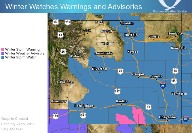
A Major Winter Storm will Impact much of Southern and Eastern Wyoming beginning Wednesday night until Friday. Northwest Wyoming including Star Valley will escape much of the storm as it tracks out into the Plains. Following are some excellent products about the storm from the National Weather Service in Riverton WY.
SYNOPSIS: A major winter storm is taking shape for central and southern Wyoming from late tonight through Friday morning. Some snow is expected today mainly along and south of Interstate 80. After sunset, snowfall will begin to increase in coverage and intensity across southern Wyoming. This snowfall is expected to overspread central Wyoming by around midnight Wednesday night. Periods of snow are then expected to continue through Thursday night, before gradually subsiding by around midday Friday. The heaviest snowfall with this winter storm is expected between the predawn hours Thursday to early Thursday afternoon. Snowfall rates of 1 to possibly 2 inches an hour could occur. Very windy north to northeast wind is expected to develop early Thursday morning which will cause significant blowing and drifting snow. Whiteout conditions are expected at times in rural areas.
IMPACTS:
- Significant airline delays (likely) or cancellations possible at Casper, Riverton, and Rock Springs airports Thursday.
- Travel will become difficult or impossible especially in rural areas where whiteout conditions will be possible.
- Road closures are likely (some could be for an extended period of time). Please check wyoroad.info for the latest road conditions.
- Young livestock will be vulnerable to the cold and snowy conditions.
 |
| Forecast for 6am Thursday February 23 2017 |
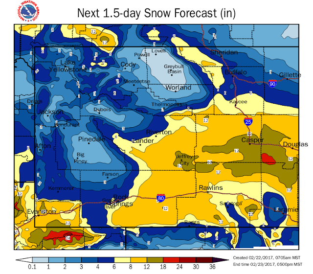 |
| Forecast snowfall for Thursday February 23 2017
|
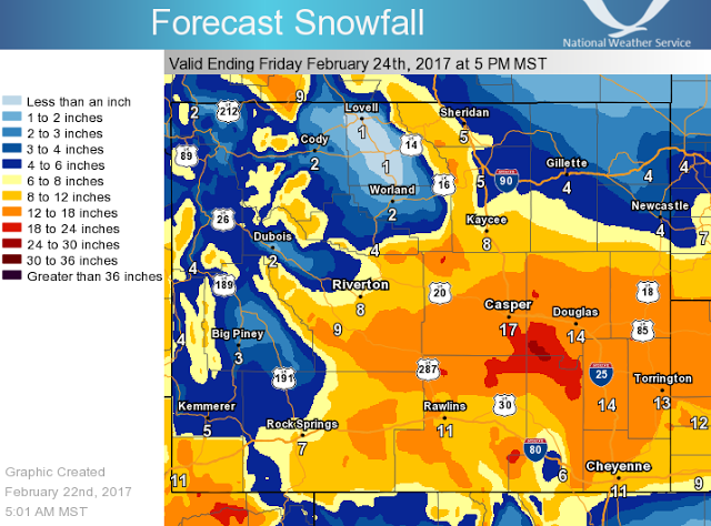 |
| Total Snowfall ending Friday evening February 24 2017
|
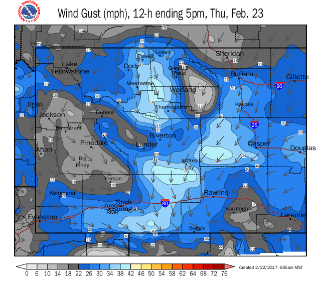 |
| Forecast Wind Gust for Thursday February 23 2017 |