URGENT - WINTER WEATHER MESSAGE
National Weather Service Riverton WY
209 PM MST Fri Jan 26 2018
...SIGNIFICANT SNOWFALL EXPECTED FOR THE WESTERN WYOMING MOUNTAINS THIS
WEEKEND...
.A couple of upper level weather disturbances will be tracking
east across Western Wyoming over this weekend and will deliver
significant snowfall to the Western Wyoming Mountains by Sunday
morning.
Salt River and Wyoming Ranges-
209 PM MST Fri Jan 26 2018
...WINTER WEATHER ADVISORY IN EFFECT FROM 5 AM SATURDAY TO 5 AM
MST SUNDAY...
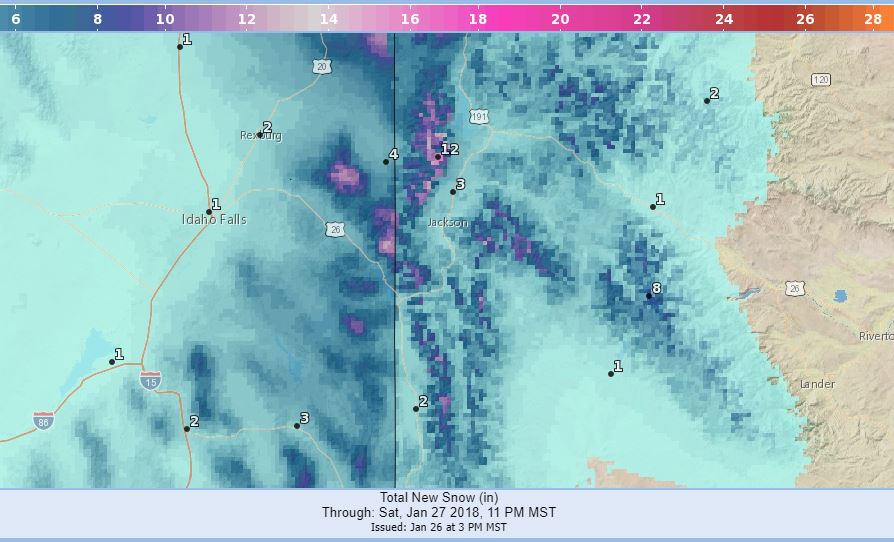
* WHAT...Snow expected. Plan on slippery road conditions. Total
snow accumulations of 5 to 10 inches expected.
* WHERE...Salt River and Wyoming Ranges.
* WHEN...5 AM Saturday to 5 AM Sunday.
* ADDITIONAL DETAILS...Be prepared for reduced visibilities at
times. Salt River Pass will experience reduced visibility and
slippery road conditions.
PRECAUTIONARY/PREPAREDNESS ACTIONS...
A Winter Weather Advisory for snow means periods of snow will
cause primarily travel difficulties. Be prepared for snow covered
roads and limited visibilities, and use caution while driving.
The latest road conditions for the state you are calling from can
be obtained by calling 5 1 1.