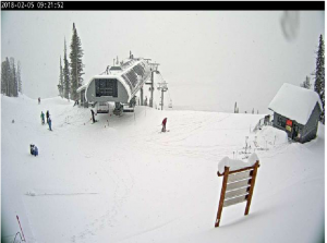
 Top of Teton Gondola
Public Information Statement
National Weather Service Riverton WY
0802 AM MST Mon Feb 05 2018

...Preliminary Snowfall Totals from Saturday Afternoon through
Sunday night...

Here are snowfall totals across the mountains of northern and
western Wyoming through Sunday afternoon. Additional snowfall totals
will be added as reports are received this morning.

Note: SnoTELS (Snow Telemetry) are remote sensing sites in high
mountain watersheds. Snowfall data from SNOTELS are estimated based
on snow water equivalent.


Location                              Snowfall

Big Horn County...
 Shell Creek Snotel...               15 inches.
 Bald Mountain Snotel...             12 inches.
 Bone Springs Divide Snotel...       12 inches.
 9 NNW Shell...                     3.3 inches.
 9 ENE Greybull...                    3 inches.
 Greybull...                        2.3 inches.
 2 SSW Lovell...                      2 inches.
 1 W Lovell...                        1 inch.
 7 W Basin...                       0.8 inches.

Fremont County...
 Burroughs Creek Snotel...           11 inches.
 Brooks Lake...                      10 inches.
 Little Warm Snotel...                5 inches.
 Castle Creek Snotel...               5 inches.
 Deer Park Snotel...                  2 inches.
 Townsend Creek Snotel...             1 inch.
 South Pass Snotel...                 1 inch.
 Cold Springs Snotel...               1 inch.
 Riverton Airport...                0.3 inches.

Hot Springs County...
 9 NE Thermopolis...                0.4 inches.
 Kirby...                           0.2 inches.

Johnson County...
 Cloud Peak Reservoir Snotel...      10 inches.
 Bear Trap Meadow Snotel...           8 inches.
 Hansen Sawmill Snotel...             5 inches.
 Soldier Park Snotel...               5 inches.
 Little Goose Snotel...               5 inches.
 13 SSE Buffalo...                    5 inches.
 17 E Kaycee...                     3.8 inches.
 4 SSW Buffalo...                   3.5 inches.
 Buffalo...                         2.4 inches.

Lincoln County...
 Commissary Ridge...                 15 inches.
 Blind Bull Summit Snotel...         15 inches.
 Blind Bull Summit...                11 inches.
 Spring Creek Divide Snotel...        6 inches.
 Willow Creek Snotel...               5 inches.
 Cottonwood Creek Snotel...           4 inches.
 Hams Fork Snotel...                  4 inches.
 Kelley Ranger Station Snotel...      3 inches.
 Box Y Ranch...                       2 inches.
 Indian Creek Snotel...               1 inch.
 Salt River Summit Snotel...          1 inch.

Natrona County...
 Grave Springs Snotel...              2 inches.
 1 S Casper...                      0.1 inches.

Park County...
 Evening Star Snotel...              17 inches.
 Beartooth Highway...                15 inches.
 Wolverine Snotel...                 10 inches.
 Kirwin Snotel...                     9 inches.
 Beartooth Lake Snotel...             9 inches.
 Blackwater Snotel...                 7 inches.
 9 SW Cody...                       2.5 inches.
 Marquette Snotel...                  1 inch.
 2 WSW Cody...                        1 inch.
 Cody...                            0.5 inches.
 Cody...                            0.5 inches.
 4 SW Powell...                     0.5 inches.
 3 NE Clark...                      0.5 inches.
 3 NE Sunshine...                   0.5 inches.
 4 SE Cody...                       0.4 inches.
 Powell...                          0.3 inches.
 4 ENE Powell...                    0.3 inches.
 26 SW Cody...                      0.2 inches.
 Pahaska...                         0.1 inches.

Sublette County...
 Triple Peak Snotel...               15 inches.
 Gunsite Pass Snotel...               8 inches.
 Loomis Park Snotel...                7 inches.
 New Fork Lake Snotel...              7 inches.
 Snider Basin Snotel...               5 inches.
 Kendall Ranger Station Snotel...     5 inches.
 Elkhart Park G.S. Snotel...          4 inches.
 Bondurant...                       1.6 inches.
 Pocket Creek Snotel...               1 inch.
 Big Sandy Opening Snotel...          1 inch.
 East Rim Divide Snotel...            1 inch.
 Larsen Creek Snotel...               1 inch.
 14 NW Pinedale...                  0.4 inches.
 Pinedale...                        0.3 inches.

Teton County...
 Togwotee Mountain Lodge...          13 inches.
 Togwotee Pass Snotel...             12 inches.
 Grand Targhee Snotel...             10 inches.
 Grand Targhee - Chief Joseph...      9 inches.
 Jackson Hole - Raymer...             8 inches.
 Jackson Hole - Mid Mountain...       8 inches.
 Jackson Hole - Rendezvous Bowl...    7 inches.
 Phillips Bench Snotel...             7 inches.
 Grassy Lake Snotel...                6 inches.
 Snake River Stn Snotel...            2 inches.
 Gros Ventre Summit Snotel...         2 inches.
 Snow King...                       1.1 inches.
 Base Camp Snotel...                  1 inch.
 Granite Creek Snotel...              1 inch.
 Moose...                           0.1 inches.
 Jackson Hole - Base...             0.1 inches.

Washakie County...
 Powder River Pass Snotel...         19 inches.
 5 NNW Ten Sleep...                 4.8 inches.
 Ten Sleep...                       3.5 inches.
 4 NE Ten Sleep...                  3.5 inches.
 Middle Powder Snotel...              3 inches.
 16 SSE Ten Sleep...                  1 inch.
 27 S Ten Sleep...                  0.3 inches.

Yellowstone National Park...
 Lewis Lake Divide Snotel...         12 inches.
 Parker Peak Snotel...                8 inches.
 Two Ocean Plateau Snotel...          7 inches.
 Sylvan Lake Snotel...                5 inches.
 Thumb Divide Snotel...               3 inches.
 Sylvan Road Snotel...                3 inches.
 Canyon Snotel...                     3 inches.