URGENT - IMMEDIATE BROADCAST REQUESTED
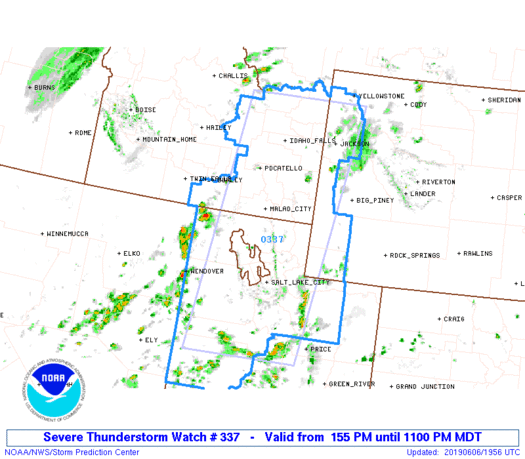
   Severe Thunderstorm Watch Number 337
   NWS Storm Prediction Center Norman OK
   155 PM MDT Thu Jun 6 2019

   The NWS Storm Prediction Center has issued a

   * Severe Thunderstorm Watch for portions of
     Southeast Idaho
     Western Central and Northern Utah
     Western Wyoming

   * Effective this Thursday afternoon and evening from 155 PM until
     1100 PM MDT.

   * Primary threats include...
     Scattered damaging wind gusts to 70 mph possible
     Scattered large hail events to 1.5 inches in diameter possible

   SUMMARY...Scattered thunderstorms are expected to form throughout
   the watch area this afternoon and early evening.  Storms should be
   high-based and fast-moving, with a risk of damaging wind gusts and
   hail in the strongest cells.

   The severe thunderstorm watch area is approximately along and 75
   statute miles east and west of a line from 65 miles north northeast
   of Idaho Falls ID to 10 miles southeast of Delta UT. For a complete
   depiction of the watch see the associated watch outline update
   (WOUS64 KWNS WOU7).

   PRECAUTIONARY/PREPAREDNESS ACTIONS...

   REMEMBER...A Severe Thunderstorm Watch means conditions are
   favorable for severe thunderstorms in and close to the watch area.
   Persons in these areas should be on the lookout for threatening
   weather conditions and listen for later statements and possible
   warnings. Severe thunderstorms can and occasionally do produce
   tornadoes.

   &&

   OTHER WATCH INFORMATION...CONTINUE...WW 335...WW 336...

   AVIATION...A few severe thunderstorms with hail surface and aloft to
   1.5 inches. Extreme turbulence and surface wind gusts to 60 knots. A
   few cumulonimbi with maximum tops to 500. Mean storm motion vector
   24035.

   ...Hart