Brutally Cold Airmass Heading for Wyoming
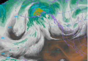
The morning view from space of the water vapor imagery provides an ominous pattern developing over the Eastern Pacific as a very strong upper level ridge develops northward into Alaska.
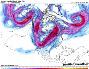
The following sequence of 500mb charts display the response downstream over the Rockies the next few days.
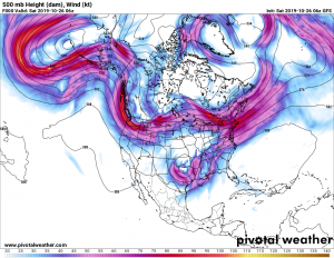
500mb Chart Saturday morning October 26 2019
500mb forecast Monday morning October 28 2019
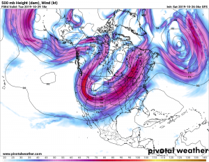
500 mb forecast Wednesday morning October 30 2019
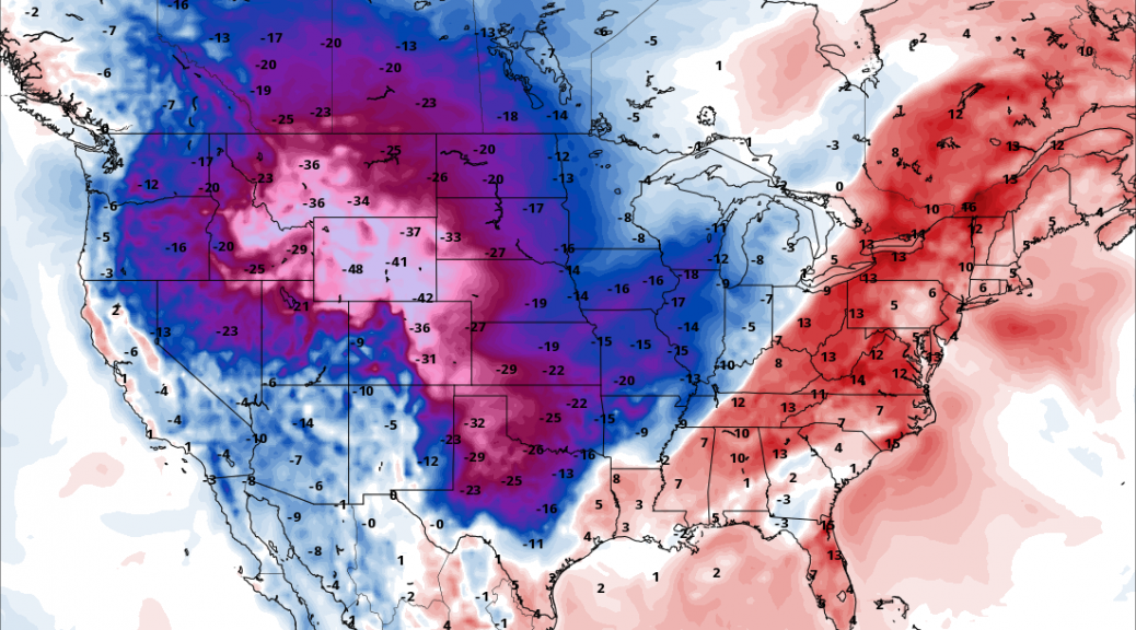
This pattern will bring an unprecedented cold outbreak into the Northern and Central Rockies, beginning this weekend and then bottoming out by mid week.
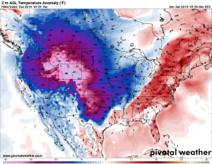
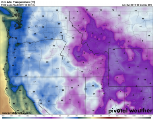
Much of Wyoming will be 40 or more degrees below late October temperatures by Tuesday afternoon. This puts higher mountain areas below zero all day with teens in the valleys, including Star Valley.
By Wednesday morning undoubtedly minimum temperatures will be near or below zero even in the lower valleys.