Initial Wyoming Spring 2019 Snowmelt Flood Potential
Quick Synopsis:
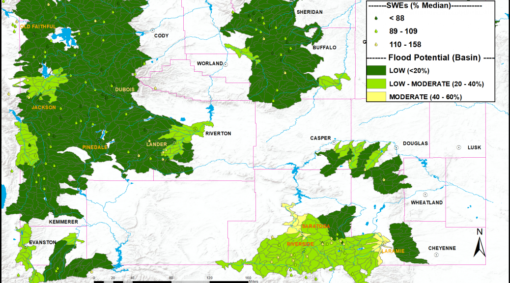
Mountain snowpack and associated snow water equivalents (SWEs) across most of Wyoming were generally near to slightly above average by late February. SWEs at the peak snowmelt runoff elevations (8,500’ – 10,000’) were the highest across the Little Snake and Upper North Platte Basins at 105 to 115 percent of median. The Upper Yellowstone and Tongue Drainages had SWEs at 85 to near 95 percent of median at the peak snowmelt runoff elevations.
This outlook is based on various diverse hydrological factors such as snow water equivalents (SWEs) in the mountain snowpack, basin morphology (i.e. how basins respond to snowmelt runoff), antecedent soil moisture, biological/physical factors (bark beetle kill/spruce blight///fire burn scars), low elevation snow depths, and likely temperature and precipitation trends during late spring/early summer.
Highlights:
…Moderate potential for snowmelt runoff flooding is forecasted along the lower portions of the Upper North Platte River Basin (near Saratoga) and along the lower portions of the Laramie Watershed (near Laramie)…
…All other of headwater basins across Wyoming can expect a generally Low potential for flooding due to springtime snowmelt runoff…
The current Wyoming Spring 2019 Snowmelt Runoff Flood Potential Outlook graphic:
