Winter Weather Coming to Wyoming
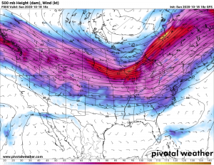
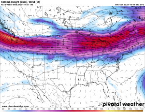
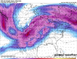
A strong westerly jet stream currently across the northern United States, will buckle by the end of the coming week which will usher in the first real taste of winter to Wyoming and surrounding states. The following is a series of 500 mb charts illustrating the forecasted dramatic change in the jet stream.
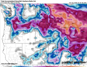
While the temperatures will remain mild with mostly dry conditions across Star Valley and surrounding areas through mid week, much colder air and snow will be the rule by the weekend. There is the potential for significant snowfall across the area with likelihood of feet in the high mountains and several inches in the valleys including Star Valley. The computer models forecast of total snowfall through next weekend is just a first guess as the system event is still 4-5 days away.
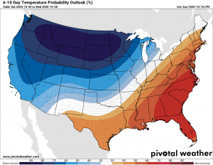
Much colder air will drop temperatures well below normal by the weekend with likely the first below zero temperatures possible in coldest locations by the end of the weekend. Following is the forecast of temperature departure from normal from the National Weather Service
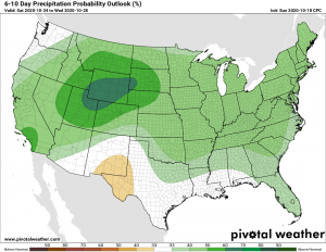
For the same forecast period the NWS is highlighting much of Wyoming for significant precipitation, likely snow.
As this change is still several days away, details will become clearer by midweek.