Snow Followed by Bitter Cold this Weekend
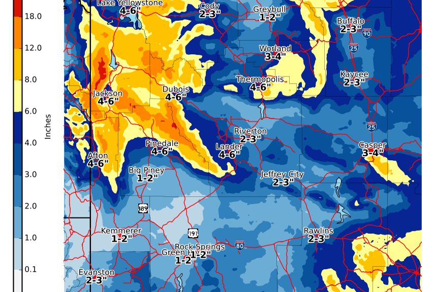
National Weather Service Riverton WY
349 PM MDT Fri Oct 23 2020

...Snow to impact Northwest Wyoming followed by Bitter Cold
Temperatures...

.Weather system will bring snow to northwest and west Wyoming
starting late this evening, continuing through the day Saturday,
decreasing Saturday night. The snowfall will spread to areas east
of the Divide by Saturday afternoon and continue through Sunday
morning. Bitter cold temperatures will be in place by late
Saturday night and Sunday morning.

Star Valley-
Including the cities of Afton, Alpine, Star Valley Ranch,
and Thayne
349 PM MDT Fri Oct 23 2020

...WINTER WEATHER ADVISORY IN EFFECT FROM MIDNIGHT TONIGHT TO
MIDNIGHT MDT SATURDAY NIGHT...

* WHAT...Snow. Total snow accumulations of 3 to 6 inches, locally
  higher amounts in the north part of the valley near Alpine.

* WHERE...Star Valley.

* WHEN...From midnight tonight to midnight MDT Saturday night.

* IMPACTS...Travel could be difficult at times. Some roads will be
  snow covered and slick. Some drifting snow will be possible.

* ADDITIONAL DETAILS...Wind chill values will be in the single
  digits to around zero Saturday night. Outdoor enthusiasts should
  be prepared for winter conditions.

PRECAUTIONARY/PREPAREDNESS ACTIONS...

Slow down and use caution while traveling.

The latest road conditions for the state you are calling from can
be obtained by calling 5 1 1.
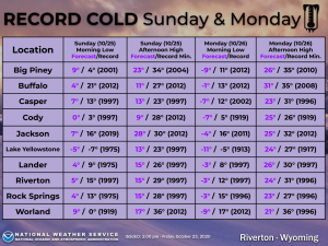
Record Cold* coming Sunday and Monday with readings below zero by Monday morning. Brrr! Bundle up Monday for the commute to school and work. Some of these temperatures will obliterate previous records, while at the same time setting records for the month of October and for so early in the season.
Table of expected temperatures around Wyoming this weekend